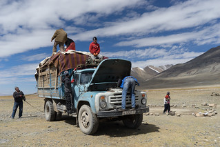
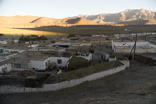
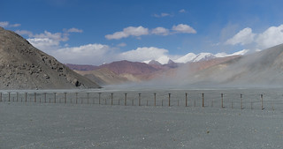
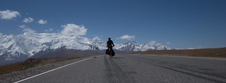
I am writing this from a “hotel” at the border between China and Kyrgyzstan, where Lindsey and I are staying for $4 each, and for which I think we probably overpaid. There is no running water (or Internet), and the bathroom is a row of squat toilets behind a brick wall. We were forced to stay here because China forbids (apparently a new rule) people to travel independently for the first 140 kilometers on the road to Kashgar (“It is not allowed”), so we have to get a taxi to cover this distance. However, we arrived at the border in the late afternoon, after the last taxi had left. The border guards would not let us hitch a ride on a truck, and instead told us we had to wait until the next day. So we are at this hotel.
We’re using this break between Central Asia and China to write about the past three weeks of biking, which have been the most remote, challenging, and beautiful of the entire trip. This leg included fierce headwinds with snow, a night in a yurt, and empty valleys where we followed jeep tracks and saw a herd of Marco Polo Sheep, almost the entire time cycling above 10,000 feet in elevation.
Lindsey and I are team writing this post, as it is broken down into a few sections of travel.
The Wakhan Valley
by David
If you look at a map of Afghanistan, you’ll see a tongue sticking out of the northeast part of the country, separating Tajikistan from Pakistan. The Afghan-Pakistan border follows the peaks of the Hindu Kush mountains along the southern edge of the tongue, while Afghanistan’s border with Tajikistan, on the northern edge of the tongue, is formed by the Panj and Pamir Rivers. In some places, Afghanistan is only a few miles wide.
This strange geography is a product of the “Great Game” between Russia and England. In the 1890s, after years of jockeying for position in Central Asia, the two great powers decided that there should be a neutral patch of land between British India and modern-day Tajikistan, which was then part of the Russian Empire — so they agreed to create the “Wakhan Corridor,” the tongue of Afghanistan sitting between these two regions. In planning our route across Tajikistan, we had talked to a well-traveled cyclist (Kate Harris of Cycling Silk), who told us that this route, which passes through Tajikistan’s Zorkul Nature Preserve, was one of the most scenic routes she had ever biked. Intrigued by her descriptions and by the remoteness suggested by such a history, we made a plan was to follow this border as far as we could, tracing the line in the map that was designated as two empires’ no-man’s-land.
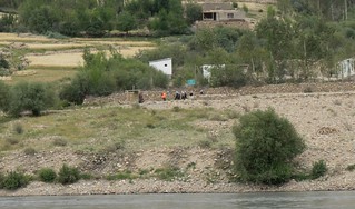
We left Khorog on a Sunday and continued following the Panj River upstream. The first night out, we camped on a sand bar hidden from the road on the Tajik side, but in plain view of an Afghan village, about 100 meters away across the river. In the morning, as we cooked cream of wheat and coffee, we heard a bell ring, and then watched children from all over the village run to school. The boys appeared to have no uniform, but all of the girls wore dark blue tunics and white headscarfs.
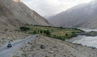
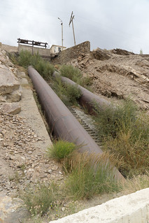
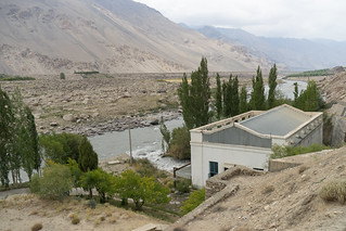
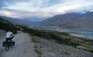
After our camp, the river then made a wide curve to the east and we entered the Wakhan Valley proper. We would spend four days in this valley, averaging less than 30 miles a day, as we took our time to enjoy the unique environment and acclimatize to the elevation. The valley climbed from about 2,500 to 3,000 meters and had 6,000 meter peaks on either side. Every few kilometers we’d pass a small town, usually where a glacially fed river flowed out from the mountains, and where canals leading away from the stream fed fields of wheat (which was being harvested) and apricot orchards. Stores were few and far between on this stretch, and apart from “homestays” — houses where people rent out a room and feed you dinner and breakfast for about $10 to $20 per person — restaurants were nonexistent after Ishkashim, the town at the valley’s entrance. The road quality deteriorates as one travels upriver, with the western end being mostly paved, and the eastern end mostly washboard dirt roads with occasional sand. The entire valley’s electricity is provided by a “run of the river” hydroelectric plant, which I took several pictures of when we passed it.
We spent a night in a guesthouse at Bibi Fatima hot springs (highly recommended), and at two homestays. At one of the homestays, we befriended a tourist guide who spoke English and who grew up in Ishkashim, at the western end of the Wakhan Valley. He explained how there are numerous languages spoken in the valley. While Tajik is spoken in Ishkashim (and in the whole western part of Tajikistan), the Ryn language – which is completely different and seemingly unrelated to Tajik – is spoken in the very next town. Farther into the Wakhan Valley, they speak, unsurprisingly, “Wakhani,” although the dialect varies considerably from town to town. Across the valley, in Afghanistan, the languages are similar, but the people have been cut off from each other ever since the formation of the Soviet Union almost a century ago. However, we learned that the people in the region – in both Tajikistan and Afghanistan – are almost entirely Ismaili, a minority Muslim sect. The guide also echoed something we’ve heard other times: almost every household in the valley has a family member working in Russia, sending money home. While people participate in subsistence-level farming, most have additional income from Russia.
Our host at one of our homestays, Mavluda, spoke English (and German), and we talked with her both about life in the valley, and about whether changes in the weather had made life more or less difficult. She echoed what others have said, namely that there is much less snow now than during her childhood. She also told us that when there is less snow, there ends up being less water in the summer, which makes it more difficult to grow vegetables and other crops. We also asked her about life in the town, and what it was like during Tajikistan’s civil war in the 1990s. At the start of the civil war, Mavluda was studying in college in Dushanbe, but fled the capital and returned to her village. During the war, the road to Dushanbe was closed, and it was extremely difficult to get any goods. Mavluda said “we had no soap,” and described how hard it was to wash clothes.
Today, life is much better than during the war, but it still isn’t easy. During the winter months, it is cold and dark. Because winter mostly halts the river’s flow, the hydroelectric plant barely operates in December and January, making winters in the region very dark. Her family has a nice home, but only uses one room in the winter, as that is the only one they heat. Almost no one makes enough money to support themselves in the valley, and instead people rely on family members working in Russia.
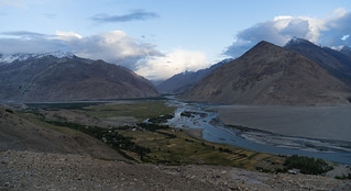
The weather was relatively sour during our short ride through the Wakhan, serving as a warning for what lay ahead. Although the area is a desert, we had some form of rainfall nearly every day, and the tops of the Hindu Kush remained mostly hidden from us. At the end of the Tajik portion of the Wakhan Valley, we climbed up above the town of Zong to gained a view of the valley, and a few of the peaks revealed themselves to us through the clouds. The river, draining the mountains around it, has filled in the valley’s bottom with sediment, which it meanders across to create a pattern of braids that changes every year. Lindsey and I sat for nearly an hour, just staring up the valley and feeling lucky to be on this journey.
After following the Panj River upstream for days, we had reached the point of its formation at the confluence of the Wakhan and the Pamir Rivers. The Tajik-Afghan border and the road along it follows the Pamir River, climbing steeply from 3,000 meters to 4,000 meters in 100 kilometers, with no settlements marked on the map. We planned to follow this river, passing by Zorkul Lake in our journey to the high Pamir Plateau.
In Search of Zorkul
by Lindsey
At our homestay in Zong, we packed up our panniers – including six days of food for the ride to Zorkul – said goodbye to our host, and rode east through the last two settlements in the Tajik Wakhan. The road climbed steeply, and the children of the last village have figured out a clever source of income: pushing cyclists up the hill and demanding money after. It was nice to have the boost, and quite affordable. I had woken up feeling achey, and as the day wore on I started getting chills. I hoped it was just getting colder with the altitude, but by the time we made camp on the bank of the river, I definitely felt feverish. I was in the tent by eight. It rained all night but cleared up in the morning, and I felt better after ten hours of sleep. We biked a half day to the checkpoint where most cyclists turn off for the Alichur Pass and rejoin the main road. This is where our Zorkul adventure would encounter a serious roadblock.
We handed our passports to the guard and told him we wanted to go to Zorkul. “Nyet,” he said, arms crossed in front of his chest in the universal symbol heralding disappointment. “Clo-zed.” “But we have permits!” we said. We handed him the permits we had carefully procured in Khorog. He looked at them skeptically and walked away to the main military building. After awhile the soldier emerged, shaking his head. He gave us back the permits and made a stamping motion with his hand, saying “Ishkashim.” We persisted, saying we didn’t understand and that the people in Khorog told us the permits were all we needed, and offering to ‘pay’ for the mysterious stamp that we apparently needed to get in Ishkashim, but with the language barrier we got nowhere. Eventually he took pity on us and brought us to a small building where some other cycle tourists, a Polish couple, were relaxing by a fire. They spoke both Russian and English, but unfortunately even with translation, matters were no clearer. It appeared that we needed a stamp from Ishkashim, but it takes four to seven hours to hitch back (if you can find a ride), and another man present told us that the ‘boss’ may not let us through even with the stamp; another said maybe the ‘boss’ would take us partway in a truck the next day, because it’s really just the border area that’s an issue; once we’re past the point where the border with Afghanistan turns south, it’s fine. Our permit, it appeared, allowed us to be in the nature reserve and even fish from the lake, but it did not allow us to travel along this section of the border. We needed a stamp from the military in Ishkashim.
We debated our options. Going to Ishkashim would take at least two days because it was only Saturday and presumably we couldn’t get the stamp until Monday. Plus, could we actually get this stamp, and would they really let us in once we had it? We were skeptical, and not excited about two days of jeep rides. Plus, I argued, the main road to Murghab would be awesome too. So we decided to carry on to the main road and abandon the idea of Zorkul. The small house where we were chatting was apparently a former ‘hotel,’ and the man in charge of the place made us dinner and let us sleep there, sharing a room with the Polish couple and dining with a few shepherds who were on their way down from the mountains due to the early snow.
The next morning the sky was clear and we sadly rode away from the inviting valley we’d hoped to cycle through, towards the main road. We left some of our extra food and fuel with the man who had made us dinner, as we wouldn’t need them on the main route. It was a rough day – David was really sad to be missing out on what was slated to be the most remote and scenic part of the ride, and I was feeling badly for not being more gung-ho about backtracking to Ishkashim for the stamp. Eventually we reached the main road, and it felt strange to be on pavement after a week on mostly dirt. At this point I started feeling more upset at missing out on Zorkul, even though the Alichur Plateau, where we had emerged, is a spectacular place. We camped that night just off the road, completely encircled by snowy mountain peaks. Over dinner, we hatched a plan to make it to Murghab, 105km away, the following day and try to get information and possibly a ride back to Ishkashim if it looked like that would work.
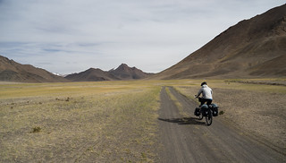
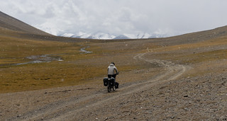
We got up and made breakfast in the cold sunrise air and were on the road before seven. However, there was a strong headwind and we rode slowly, despite being on a flat, nicely paved road. In the early afternoon, we passed a beautiful valley with a dirt road stretching off to the south. We studied our map and saw that this road would take us to Zorkul from the opposite direction, and that it connected with yet another road that led back to the main road, thus enabling a sort of loop to Zorkul, with only a little bit of backtracking. We were tempted, but we didn’t have very much water with us so we kept going. Shortly after, though, we passed a small stream. We filled up our water bottles and had a quick consultation – we both were still craving a remote adventure, so we counted calories and determined that we could supplement our diminished supplies at a hunting camp about halfway through the ride. We also consulted the guide in a passing jeep, who told us that the bush growing everywhere burns well, so we could use that to cook if we ran out of fuel. Thus ‘prepared,’ we left the main road and headed toward the elusive Zorkul. It was brilliant riding – the sun was shining, the dirt road was in shockingly good condition, and the wide valley, framed by reddish rocks on both sides with a little stream running through the middle, was so inviting.
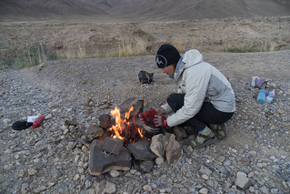
We stopped early to make camp by the stream and try our hand at building a fire. While we eventually managed to cook our rice, I’ll just say that we found ourselves empathizing with people who have to heat their homes and cook all their food on such fires all winter long. We are novices, and I’m sure one improves with practice, but it is hard work getting small shrubs and dried dung to catch fire and keep burning. Dinner was delicious though. We learned the next day, however, that the seemingly ubiquitous shrubs are actually very slow-growing and that you shouldn’t trample or pull them, so we felt quite bad about it and resolved to top off our fuel at the hunting camp so we wouldn’t have to make any more fires. For the rest of our time in the region, we noticed huge piles of these bushes next to people’s houses, on wagons and trucks, etc. – people were stocking up for the winter.
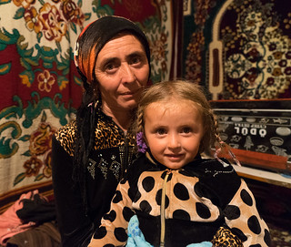
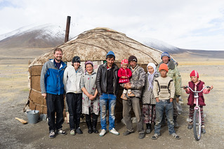
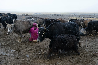
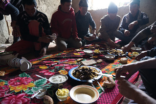
The next day started off clear and sunny, and we kept following the valley, stumbling on some massive Marco Polo sheep horns along the way. We had seen quite a lot in the Wakhan Valley – people put them above doors or in shrines – and this set had been placed on a rock by the side of the road. In the early afternoon, we started to see yurts here and there, as well as herds of yaks grazing. It also started to snow a bit, and when a family invited us into their yurt for tea, we gladly accepted. Once inside the cozy yurt, which was richly decorated with handmade textiles and smelled faintly of spices and tea, we were served bread, butter and yogurt. We had been conserving food to make supplies last, so this was a welcome supplement; plus, it turns out, yak dairy is sweet, rich, and delicious. The snow picked up, and we kept saying we would leave as soon as it cleared up, to which our hostess, Mahabat, said ‘No! Sleep here!’ She spoke a bit of English and we were able to communicate fairly well between that, our limited Russian and Kyrgyz (the population in eastern Tajikistan is primarily Kyrgyz), and our phrasebook. We said we could set up our tent, but she scoffed at the idea. With the steadily worsening weather and an invitation to spend the night, our plans changed and we settled in. We ventured outside to watch the yaks come home and be wrangled into their paddock (a very tough, physical job that most of the family, from Mahabat’s teenage nephews to her mother-in-law, took part in), then had dinner before bedding down on the floor for a slumber party with the family.
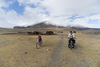
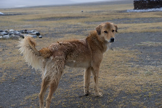
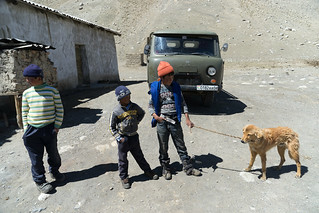
At 5:00, Mahabat got up to milk the yaks. We came out a bit later, but my offers to help were rejected. I doubt I would have been much help – I have milked a cow and a goat in the past (or at least tried) but I don’t really have much skill. It looked like cold, dirty work, especially as it was still snowing. Once it cleared up we said our farewells and headed out toward Lake Zorkul with a couple of family members in tow — Mahabat’s daughter, on a bike, and the family dog, running. While our human escort turned back after awhile, the dog followed us all day, despite vigorous discouragement on our part.
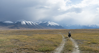
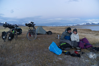
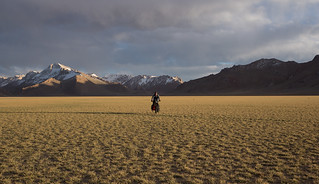
In the late afternoon we found ourselves riding up a pass in the snow when a jeep stopped right in front of us. A Finnish tourist and his guide leapt out and gestured to the mountain next to us. Following their lead, we looked up and saw a large herd of Marco Polo sheep at the very top. We hadn’t even hoped to see any of these animals, so we were thrilled at the good timing of the jeep, especially since they let us borrow their binoculars for a closer look. After this auspicious sighting, we descended into the widest and most beautiful valley yet. The sunlight on the mountains to the south looked unreal, and we pressed on into the wind, hoping to make it as far into the park as possible. Soon, we passed a sign for Zorkul, and shortly afterwards two men drove up on a motorbike and asked to see our permits. It was the moment of truth we had dreaded – would they let us in? Lucky for us, the answer was yes, and we rode on. The wind made progress slow, and early evening found us by the shores of the second lake in the valley, short of Zorkul but a spectacular place to camp. It was freezing and windy, and while making dinner I kept looking up to the mountain ranges around me to remind (or convince) myself that the discomfort was worth it.
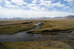
The next morning, David rode a bit farther in order to catch a glimpse of our original destination – Zorkul Lake, for which the reserve is named – while I stayed in the tent in an attempt to keep my fingers and toes from freezing. After breakfast, which we shared with the dog who was still with us, we headed back, satisfied with having reached Zorkul and running low on supplies. We stopped for lunch at a yurt camp and watched people disassembling the homes they had lived in all summer. The nomadic culture in this area was intriguing – people spend about six months a year up in the pastures, then make the short journey to Murghab where they live for the rest of the year. Murghab is the biggest town in eastern Tajikistan, but as we learned when we got there several days later, it isn’t exactly a metropolis. Nonetheless there are several schools where the nomadic families’ children study for part of the year. Despite being located in Tajikistan, the population is overwhelmingly Kyrgyz, and many people don’t speak Tajik; three of Murghab’s four schools are taught in Kyrgyz, and most of the teenagers we spoke with plan to go to university in Kyrgyzstan. While living in yurts and herding yaks may seem rustic and old-fashioned, we found the people we met to be just as modern and integrated into mainstream society as anybody else in Central Asia. Several of the younger people spoke some English, the family that hosted us uses Facebook, and one girl said she hopes to become a doctor. We joined them for lunch – pasta with yak meat – and, feeling recharged, rode on to the hunting camp we’d spotted on the map. There we bought a bit of food to last us to the main road, and we also left the dog with the people who ran the place, once we confirmed that they knew his family. We figured if he could be prevented from following us, he would make his way home on his own (about five miles), or word would get to the family that he was there and they could come and get him.
The next morning, though, we woke up feeling like terrible people and decided to go back and personally escort the dog to his yurt. After all, his family had fed and sheltered us, and we weren’t entirely sure if the people at the hunting camp would be able to get him home. So, just one day out from an actual town, where the hot shower and food-other-than-rice-pasta-and-cream-of-wheat we’d been dreaming of awaited, we turned around and rode the 20km back to the hunting camp. As we approached, we saw two familiar sights: the dog, lying behind one of the buildings; and the family’s truck. As it turned out, they come to the hunting camp once a week to bathe in the hot springs; it just so happened that we had left their dog there the day before their visit. So, while we didn’t need to return to ensure that the dog was reunited with its family, we felt much better knowing he was on his way home, and it gave us another chance to hang out with our new friends, as well as a bathing opportunity even better than the evasive hot shower I’d been craving. There was a men’s and women’s side, and I spent at least an hour in the hot pool with three generations of the women of the family. We took turns bathing in metal tubs, and after that, playing games with the two little girls, and some nice tea and bread, my rush to leave the wilderness abated. However, soon the family headed back to their yurt, dog in tow, and we turned our bikes around yet again. We rode past our campsite from the night before, crossed a dry lakebed, and then camped under a waxing moon in an empty canyon full of stars. It was the warmest night in awhile (i.e., I was able to sleep without my down jacket on) and we had a relaxed evening and morning, enjoying the last bit of our Zorkul adventure. The following day we reconnected with the main road and coasted the last 25km into Murghab, where intermittent hot water, even more intermittent Internet, and a bazaar made up of shipping containers awaited us.
Back on the M41
by David
We returned to pavement, eager for a hot shower, maybe some Internet, and the ability to pay for a hotel room. Or at least, that is what we hoped we would find in Murghab, the largest settlement in the Pamir Plateau.
We arrived in Murghab in the early afternoon and set off on our quest. Murghab, which at 3,600 meters above sea level was the lowest elevation we had been at since leaving the Wakhan Valley, and it was the first time in weeks that we had been able to cycle in shorts. It sits next to the Murghab River, which meanders and braids across a green floodplain — however, the surrounding mountains are mostly free of vegetation, as this region is far drier than the valleys to the south.
The town felt depressing… and it’s hard to exactly say why. The homes seemed a bit crowded, and few have running water. Smoke rose from many of the homes, as they burn dung to cook and keep the house warm — tasks that likely become far more challenging in the winter months. The town’s main “bazaar” is a series of shipping containers that have been transformed into small shops selling a seemingly random assortment of goods.
Our quest for comfort and recharge was only partially successful. The hotel, it turned out, didn’t yet have hot water, so I had to settle for a cold shower. The one place in town with wireless Internet (the “American Corner”) was closed because it was a Saturday, and wouldn’t open until Monday. We were, though, able to get some (*very*) limited Internet through my phone, and even if we couldn’t get completely comfortable, the hotel had a relatively decent restaurant (of course, only one or two items were on the “menu” at a time), and our electronics found sufficient outlets to recharge.
We had assumed that we would need only two and a half days to reach the border, and that the riding along the Pamir Highway, M41, would be relatively easy compared to the riding we did in Zorkul. We were very wrong — at least about how easy it would be.
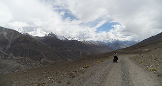
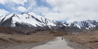
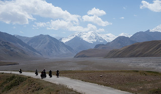
The first day was, in fact, easy — we left Murghab in the late afternoon and biked 30 kilometers with a strong tailwind. The next day, though, that tailwind became a headwind. This day would take us over the highest pass of the trip so far — 4,655 meters above sea level. The wind picked up as the day progressed, blowing into our faces as we struggled up the pass. I felt the altitude more strongly than Lindsey, and she had to wait for me in the cold wind.
On the far side, I looked forward to a long descent from the highest pass, and I thought, because the road curved right, we might have a tailwind. The descent, though, turned out to not be paved, and the headwind did not let up, leading to one of the least satisfying and most frustrating descents of this trip. Moreover, it kept us from reaching our goal, Lake Karakul, and we camped about 20 kilometers short.
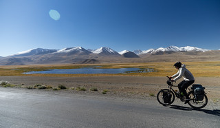
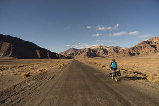
The next day, we biked to the lake, where at the first settlement we’d seen since Murghab we purchased some fuel for our stove, a few sugary snacks, and some bread (the one open store didn’t have any bread, and we had to ask around until someone brought us back to her house to sell us some). We continued around Karakul, a fantastic deep blue lake surrounded by five and six thousand meter peaks. Then, as we neared the border, the wind picked up.
Much stronger than the day before, it blew directly into our faces, forcing icy air into our chapped lips and nostrils. Then, the road turned to dirt and started climbing. Lindsey’s bike slipped in the sand, and she fell over twice. Angry at the elements, she engaged the kickstand and yelled at the wind and Tajikistan, throwing rocks at both for good measure*. It was not her finest moment (but, to be fair, neither was it Tajikistan’s). We ate a snickers bar and continued. We hoped to reach the border checkpoint before dark.
The Kyzyl-Art Schmutzig Singers and 24 hours in Kyrgyzstan
by David
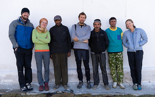
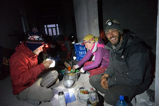
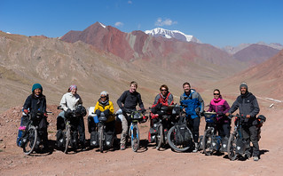
At the Tajik border (where three different people at three different buildings had to take our passports and write something in a book — we’re not sure what), we found a welcome sight, and something we hadn’t seen in a number of days: other cycle tourists. A Japanese couple (who we had met briefly in Bukhara), two friends from Holland (who I had met in Khorog), a solo cyclist from Brazil (who we had spent time with in Khorog), and a solo cyclist from Germany (who we hadn’t yet met) had literally arrived at the border minutes before us. They had already asked the guards for permission to sleep in an abandoned building at the checkpoint, out of the wind and the cold, and the guards had agreed. We joined them.
The building – we couldn’t tell whether it was abandoned or under construction – was relatively disgusting, complete with animal feces in a few of the rooms. Nonetheless, it was out of the wind, and that was all we wanted. We chatted with the other cyclists about the road ahead and behind — they had taken a more leisurely route through the Pamirs, and we envied the fact that they had just spent a few days resting at Karakul.
The two Dutch cyclists started singing a song they had written about biking in the Pamirs (set to a tune from the movie Frozen). I immediately knew we had to make a music video.
The next day, all eight of us cycled up the few hundred meters to the pass between Tajikistan and Kyrgyzstan, set up our bicycles across the road, and recorded what might be the highest altitude bicycle-music-video recorded in Tajikistan or Kyrgyzstan.
The lead singers are in Tajikistan; the backup dancers and chorus are in Kyrgyzstan.
After this musical interlude, we continued down the pass into Kyrgyzstan, where we dropped down to almost 3,000 meters. Lindsey and I considered riding on, but there was a bit of a headwind, so we decided to wait until the following morning and spend the night in the Kyrgyz town of Sari-tash with a number of the other cyclists.
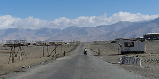
The next day was a relatively easy ride to the Chinese border. A tailwind pushed us over a pass, and then it was a long, extremely fast descent to the border. However, because China has only one time zone (everything is on Beijing time), there was a two hour time change when we left Kyrgyzstan, thus meaning we got to the border just before it closed instead of two hours earlier. As a result, although they let us through, we weren’t able to get a taxi (oddly necessary, even for cyclists, since China doesn’t let you bike this section of the road), so we spent the night at a “hotel” at the border.
* Co-author’s note: I would like to clarify that this was a controlled activity and that no gusts or parts of Tajikistan were harmed. Frustrated after days of icy wind blowing in my face, slowing us to a crawl, and chapping everything it could touch, I needed to blow off some steam, so I thought a little lung and arm exercise might do the trick. While the wind was unmoved, I felt much better and made it to the border in one piece.


