Archive for December, 2014

Cycling Bihar

Tuesday, December 30th, 2014

The warnings about Bihar started as soon as I posted our planned route. A number of people told us to avoid the state entirely. One friend wrote us and said, “we’ve gotten advice from a number of folks in the know that biking through Bihar is a really bad idea (like a 50% chance of rape and/or assault and/or kidnapping idea).”

Bihar is one of India’s poorest and most densely populated states. Over half of the population lives under the national poverty line, and the state’s population density of more than 1,100 people per square kilometer is greater than that of Bangladesh. Bihar also fares poorly with respect to education, especially for women: About a quarter of men are illiterate, while almost half of the women are. The state is also highly vulnerable to climate change—its people are at very high risk to floods, and they rely heavily on agriculture. For our project, I wanted to ride our bikes across this part of the world and witness it firsthand. But first we needed to figure out if we would survive such a ride.

India 1 - Bihar

We receive many warnings about “far away,” “unknown” places, which often seem dangerous to people who haven’t been there. But the Bihar warnings were unusually strong and warranted more research, in part because they came from some people who _had_ been there, or were well-traveled and very familiar with India. We emailed everyone we could think of who might know people in Bihar. We wanted to find someone who knew the state well enough to tell us the safety of specific towns and roads in Bihar.

We found that person in Ashutosh Ranjan, a Clinton Global Fellow who grew up in northern Bihar and now lives in Delhi. After some equivocation, he told us which parts of the state were more troublesome than others and recommended a bike route. More importantly, he was able to find local contacts in almost every city we would spend the night in. These contacts could help us find hotels (Ashutosh, as well as everyone else we spoke to, strongly recommended against camping or traveling after dark) and assist us with other challenges we might face. Such local help is invaluable, and we decided to take Ashutosh’s advice and cross the state.

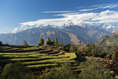
After two days of riding from Kathmandu, we arrived at the border between Nepal and India (and thus Bihar, as the state borders Nepal just south of Kathmandu), which we crossed early in the morning. It was the least patrolled border I’ve ever crossed. Indians and Nepalis don’t have to show their passports—they can freely cross. As a result, there’s little security. We biked across a bridge (where we had to wedge our bikes around parked trucks waiting to cross), only to learn that we’d accidentally left Nepal. We had to turn around and bike back a few hundred meters to the Nepal customs office, which we had passed without noticing it. The office was challenging to find, but a friendly man standing by a trash fire waved us into a small building. They weren’t very busy, and the officer offered us some tea.

Nepal - Cycling and Kathamndu

We biked back to the Indian side and found the corresponding customs office in a small room with a low ceiling and a tangle of cables for two computers. The agent then told us that their Internet wasn’t working, and we’d have to wait for them to connect to approve our crossing. Then we got worse news. The Indian Embassy that issued my visa (in Dushanbe, Tajikistan), had written my passport number incorrectly—they had randomly added a “2” to the middle of the number on the visa. We hadn’t noticed this mistake until the customs officer pointed it out. Now this obvious error could prevent him from approving our entry. The officer made a number of calls to his higher-ups in Delhi, and we waited.

Four and a half hours later (during which time only one other tourist passed through the office), someone in an office in Delhi approved our passage. Now, though, we had a dilemma—it was 12:30 PM, and we had just four and a half hours to make it 50 km before dark. If the roads were good, it would be no problem. If they were dirt, we might have to start our ride in Bihar doing exactly what everyone told us not to do: ride after dark.

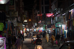
We started biking. The border town was gross. The street was crowded with people, almost all of them men. A few (holy) cows picked at the trash that lined the road. I looked for something to eat, but the food at all the stands appeared to have been sitting out for a few hours, and I didn’t think I could eat it without getting sick. A cool thick fog made everything even less attractive. The only part I enjoyed was watching a man parallel park his cart pulled by two Brahman bulls.

An orderless mix of trucks and rickshaws were backed up behind the train tracks, waiting for the people operating the gate to push it up. Bicycles and pedestrians were able to duck around and cross the pair of tracks, and we did the same. On the other side of the tracks, though, we had to walk far around the gate and cross a moat of black viscous water, using two narrow boards that had been laid down for this purpose. We passed a table where a dozen dead chickens, feathers plucked, sat for sale. Beneath the stand, another two dozen chickens lay, all still alive, but with their feet tied together. They seemed remarkably relaxed given their circumstances.

India 1 - Bihar

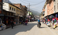
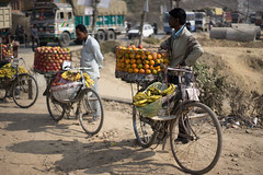
The road quality changed every few miles from smooth new pavement, to under construction (although it was unclear if anyone was actually working on the road, or if it was just a perpetual “work in progress”), to horrible dirt. We encountered numerous “spontaneous impasses”—a unique breed of traffic jam where vehicles tried to pass each other in each direction, leading to four vehicles stopped in place, facing each other in a pointless standoff. Trucks, vans, buses, and motorcycles would try to pass the stopped vehicles, ignoring lanes and filling every space on the road, making it impossible for people to back up and resolve the mess. On bicycles (or “cycles” as they are called here), we were able to maneuver our way around and pass, albeit very slowly.

India 1 - Bihar

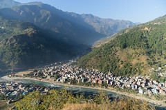
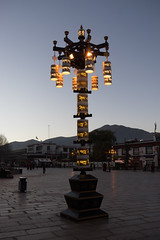
We arrived in Motihari just before dark, and called Dushyant, the first contact that Ashutosh had arranged for us. I felt ill at ease—small three wheeled vehicles, cycles, and motorbikes moved through the streets like water flowing. To cross a street, you have no option but to walk slowly into the street, trusting that the traffic will flow around you like a rock in a stream. Dushyant found us a hotel where we could get a room for $10, and we met him there.
We didn’t leave the hotel for dinner—Dushyant said we would be surrounded by people, and it would be unpleasant (although not unsafe, he said). So he went to a restaurant, got us food, and brought it back to our hotel room. Like many people we met, Dushyant was surprised that we thought it wouldn’t be safe in his town. But he also then told us, and especially Lindsey, not to go out after dark.

For the next week, we traveled through Bihar following basically this routine: rise early, eat breakfast at our hotel, and bike hurriedly to a city where we knew we would be able to spend the night (and for some reason, we were always getting into town right before dark and feeling rushed, just like the first day). On arrival, we’d meet our local contact, usually at a hotel they’d recommended, eat dinner at the hotel, and go to bed. This was made possible because nearly all of the hotels had restaurants and room service, making it even easier to not wander into town.

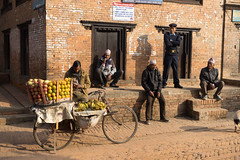
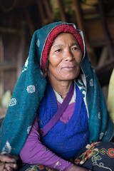
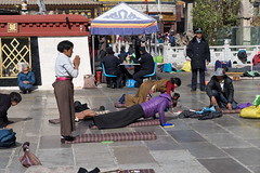
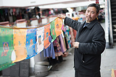
It was difficult to stop along the road in Bihar, because a crowd would immediately form. The population density in Bihar is 30 times higher than in the United States. There are people everywhere, and they’re not accustomed to seeing foreigners. So, when we stopped, people would surround us within seconds. Sometimes someone would say “Which country?,” asking where we were from. But mostly they just stared, looking at us as if aliens had landed. One person even asked me, “are you human?” And of course, the crowds were entirely men—we saw very few women in the streets. We never felt unsafe with these crowds, but we always felt uncomfortable, and as a result, we almost never stopped for long on the side of the road.

India 1 - Bihar

I also spent about half my time battling some type of stomach bacteria. Two nights I felt so ill I thought we wouldn’t be able to continue the next day. Fortunately, rest and antibiotics gave me enough strength to keep riding. But it is a horrible feeling to be sick during the middle of the day and feel like you have to keep going because you have to make it to a hotel for the night.

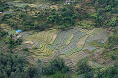
Our longest stop was in the town of Tribeniganj, where Ashutosh had arranged for a group of volunteer social workers to meet us. The town is in a part of Bihar that suffered horrendously from floods in 2008 when an embankment in the Kosi River burst, unexpectedly flooding the homes of a few million people.

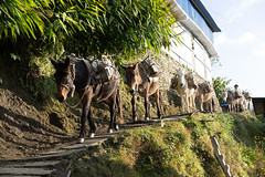
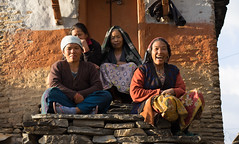
The volunteers brought us through a few villages for a tour and helped us interview people about climate change. It was amazing how many people live in these small villages—men, women (women were more present in villages), and children seem to materialize out of thin air when we stopped, emerging to stare at us. Having guides allowed us to follow small paths, sometimes paved, sometimes not, and talk to people living in the rows of small wooden houses. We asked people if the climate had changed over their lifetimes, if flooding was more or less frequent now, and whether these changes (if they noticed any) had made life harder or easier.

India 1 - Bihar

Other than the 2008 flood, people didn’t have a consistent answer on flooding. Most people said that the rains are more unpredictable than they used to be, and that the monsoon is coming later, on average, which in turn makes it challenging to plant crops at the right time. But when we asked “how have changes in the weather affected you,” they pointed out things that aren’t necessarily related to climate change. More than one person said that they needed to spend money on diesel to pump groundwater for irrigation (which could be more necessary as rains become less reliable) and use more fertilizer to grow their crops, and that the crops don’t fetch as good a price at the market as they used to.

One elderly man didn’t answer the questions at first. He said, in English, “Look how poor I am, look how simple my cottage is, how skinny I am.” At first I wanted to tell him how nice his cottage was, but I realized he was right. And this was my strongest impression from these visits—the poverty. So many people live incredibly simple lives, cooking meals over dung fires, using bulls to plow small plots of rented land, and hoping for a good harvest.

It was the poverty that got to me the most in Bihar. We saw many migrant families huddled near the roadside just outside their makeshift one-room huts, next to a small fire, trying to keep warm in the cool foggy December air.

India 1 - Bihar

And then there was the human waste. Bihar has a population of over 100 million. Ninety percent of these people do not have access to a toilet—that is, they shit outside. Almost every day—and sometimes several times a day—we’d see a man (never a woman, as it’s only considered appropriate for them to go just before sunrise or just after sunset) squatting in a field. Along some of the wider two-lane highways, we’d sometimes see rows of human feces at the edge of the shoulder near villages. It is a sight and smell I’d also like to forget. And it isn’t just gross—such lack of hygiene is a major cause of health problems in India.

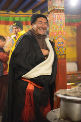
We spent our last full day in Bihar in Purnea, a town of maybe one hundred thousand on the eastern edge of the state. We planned to only stay for lunch but were persuaded to spend the night by Gririndra, a friend of a friend of Ashutosh. Gririndra insisted we visit his farm and spend the night with his family. He had attended college and worked as a journalist (I think) in Delhi, but had returned home when his father became ill, and he then took over his father’s farm. He had an arranged marriage, like most other people we’ve met here, and one daughter. “My biggest dream,” he said, “is for a good education for my daughter.”

One thing that we struggled to understand is the caste system, which appears to still be in place to some degree. Gririndra, like many (though not all) of our contacts who hosted us and helped us, was well educated and a member of the Brahmin caste—the top of the ancient caste system (though there are many divisions within this and the other castes). People would freely tell us their caste if we overcame our own discomfort with the concept and asked. But many of the people crowding into huts were of lower castes. And there were clear distinctions. We visited one farm where the landlord had a nice, large house, and behind the wall that surrounded it were rows of small huts that provided shelter for a few hundred people. It’s sad to see such differences in wealth in a society, whether in India, Latin America, or the United States. And it is especially odious when there are social norms—in this case, the caste system—that help perpetuate this unequal distribution of wealth and opportunity.

India 1 - Bihar

We didn’t know it, but Gririndra was “interviewing” us. He wrote an article about us, which he published in the Hindustani Times. The article actually said very little about our trip’s mission, and made up almost all of our quotes. It was, though, very entertaining.

10891830_10205774088656502_2114915991090174280_n

We never felt totally comfortable in Bihar, but we also never felt unsafe in the way that we worried about, based on the warnings we had received (of course, we never were outside after dark, which would probably be dangerous). A few people told us that in the past decade, largely due to better government that has cleaned up corruption and improved police enforcement, safety has increased dramatically—one person told us that people’s warnings would have been completely true in 2005, but not today. Also, numerous Biharis in almost every city we visited helped us on our journey, and we feel incredibly lucky to have made these new friends.

Nonetheless, it’s hard to look back fondly on our time in Bihar. I was sick for three and a half days, and an unpleasant, gritty fog hung over the landscape much of the time. I wish I could forget the images I have of grown men shitting outside, and the sight and smell of human feces along the edge of the highway. And the poverty—so many people live with so little. How many families did we see crowding around small fires by their huts? Or people plowing small plots of rented land using oxen? I’ve traveled through many poor parts of the world where the poverty doesn’t feel oppressive—often, my strongest impressions of rural, undeveloped areas is that the people are friendlier and smile more than I’d expect for people who lack electricity or basic sanitation. In Bihar, though, we felt like there was more of a struggle to survive, and that people were living closer to the edge. Perhaps more strongly than anywhere else we’ve visited, I felt lucky that I live in a developed, relatively un-crowded nation.

Energy and Climate in Nepal

Wednesday, December 24th, 2014

As Lindsey wrote, we were mentally unprepared for Nepal. After two and a half months in China, I had forgotten what it is like to be in a country with lagging infrastructure and rolling blackouts. We confronted the poor infrastructure immediately: What we thought would be a one day ride, from the border to Kathmandu, turned into a two day slog due to long stretches of chewed-up or nonexistent pavement. And when we looked for a hotel our first night, we had to search for one that had electricity.

Nepal - Cycling and Kathamndu

Over our next two and a half weeks, we were reminded over and over that Nepal is a poor country that uses few resources and produces very little electricity. From a climate change perspective, this means that the country produces very little greenhouse gas emissions—but it also means that, as a largely agricultural society with little infrastructure, it is highly vulnerable to a warming climate.

To better understand these issues, while in Kathmandu we spoke with a few NGOs, an intergovernmental organization (ICIMOD), and a government agency. And during our week-long trek in the Annapurna region, we spoke with about a dozen people about how changes in the weather affect them. Here’s what we found from this cursory survey.

Electricity, Energy, and Emissions

Nepal produces very little electricity. If all the country’s power plants were running at full capacity (which is possible only during the rainy season, when there is enough water for the run-of-the-river hydropower plants), there would only be enough electricity for every Nepali to turn on a single, highly efficient, compact florescent lightbulb. No refrigeration, no computers. Just one bulb per person.

Because there isn’t enough electricity, Kathmandu has daily, scheduled, rolling blackouts, such that any given block has electricity for about two-thirds of the day. For this reason, people who can afford it have a battery (or even a generator) to keep the lights on. Many shops use such batteries to power a backup light, such that the streets at night become a row of well-spaced compact florescent bulbs hanging near the front of mostly-dark rooms. The lack of electricity means that instead of traffic lights, men in uniform stand and direct traffic at major intersections. At night these men have green and red light sticks which they wave like lightsabers, as if using the force to move the vehicles. Such power outages also challenge industry—factories need expensive backup generators.

Nepal - Cycling and Kathamndu

Nepal - Cycling and Kathamndu

If Nepal is to provide better services for its people, it needs to produce more electricity—much more. The country could accomplish this goal without dramatically increasing its greenhouse gas emissions by building a series of reservoirs in the Himalaya. The economically-feasible hydropower potential is immense—about 40,000 megawatts. That would give Nepalis similar electricity per capita as most western European countries.

But nobody we met in Nepal wanted to dam as many rivers as it would take to reach a fraction of this goal. Employees of Clean Energy Nepal, a local nonprofit, argued that big dams were not the answer—they would displace people and wouldn’t be sustainable because of the heavy sediment load of the Himalayan rivers. They said that they wanted to avoid “China’s path,” and focus on smaller scale solutions. They noted that there are 200 days of sunshine in Nepal per year, making solar a great option (especially in conjunction with small hydro—small hydro works better in the rainy season, solar power works best in the dry season).

Nepal - Cycling and Kathamndu

We also met with the Alternative Energy Promotion Center, a government agency that promotes clean energy development. They support many small scale projects such as micro-hydro, improved cookstoves, and biogas (more on biogas in a minute). I asked them if they could develop their economy without using fossil fuels. The response was basically “yes, because we can use hydropower.” If they had enough hydropower, they could use the electricity to cook and heat, thus reducing some of the needs for fossil fuel. They said that distributed solar, biogas, and improved cookstoves were part of a solution, but not the entire solution to developing in a clean way—they also needed dams.

Many of these small projects, while not being the entire solution, are improving people’s quality of life without increasing greenhouse gas emissions. One example is the country’s many successful biogas projects. A consultant/researcher at Winrock, an international NGO, told me about how Winrock, other NGOs, and government agencies have helped install biogas digesters all over the country — there are now 300,000 small digesters, which allow people to take cow (or other ruminant) dung and turn it into natural gas for cooking. Using such gas is much more efficient and better for people’s health than burning the dung, which is what most people without digesters do. Two cows can provide four people with enough gas for all their cooking needs. Also, the waste from the digesters can in turn be used as fertilizer. Moreover, Nepal has been paid for the program through the Clean Development Mechanism of the Kyoto Protocol. Basically, it is a win-win-win. (Interestingly, one challenge is that people think that cooking with dung is “clean” and cooking with gas is not — getting people to use these new technologies can be challenging).

Such small-scale projects are great news. In the long run, though, Nepal will likely need much more electricity than they can provide, and the easiest way to do that cleanly is through hydropower. Hopefully the dams needed for this will be built in a sensible way that benefits all Nepalis without causing too much harm to the people and ecosystems in the areas around the proposed reservoirs.

Vulnerability and Changing Monsoons

We asked the employees of Clean Energy Nepal (CEN) what worried them about climate change in Nepal. They said: reduced agricultural output, water scarcity, and weather-related disasters, in that order. The same employees at CEN had recently surveyed 4,000 villages in the country, asking if people were experiencing climate change. The people surveyed said that the rain had become more erratic, in turn making farming more difficult.

At ICIMOD, the Director General, David Molden, told us that people in the mountains are experiencing climate change right now. Here’s an edited version of his interview. The part I found the most compelling is how he compares the urgency of climate change here in Nepal to that felt in the United States. He also noted that climate change is just one of the many problems facing mountain people.

And finally, we went into the mountains on a week-long trek (see Lindsey’s blog entry) and talked directly with people ourselves. We found that people were experiencing exactly what Dr. Molden said they were — the rains had become more unpredictable, and were coming later. Some people said these changes in rainfall made it more difficult to farm; others said it had no influence. Everyone also said that it had gotten warmer, although they were split over whether this was a good or bad thing. Higher in the mountains, some liked the warmth because they could grow more crops. Lower down, many said it was too hot.

Nepal - Trek in Anapurna

Nepal - Trek in Anapurna

I’ve seen a number of different rankings of “countries most vulnerable to climate change,” and Nepal is often near the top. After visiting the country, I can now see why, but I also think the worst effects of climate change aren’t here yet. Our survey suggests that people are noticing that the climate is changing, but for many people in Nepal these changes do not yet pose a dramatic challenge, especially given the many other problems they must cope with on a daily basis. Whether they will pose a dramatic challenge in the future depends both on how the country develops, and on how much the climate changes over the coming decades.

Nepal – Photos

Tuesday, December 23rd, 2014

We took a lot of photos in Nepal, especially during a week-long trek in the Himalaya. You can see all of these photos in our flickr albums, Nepal – Cycling and Kathmandu and Nepal – A Trek in Annapurna Below are some of our favorites selected from these albums:

A Trek in the Himalaya

Monday, December 22nd, 2014

We had done absolutely no research on Nepal, and were thus utterly unprepared – a fine thing, when your non-expectations end up wildly exceeded. If pressed to describe Nepal before arriving, I probably would have said something like ‘vaguely Indian, with big mountains. And maybe elephants.’ If asked for more, I may have mentioned landslides and a uniquely shaped flag. Crossing the border from China, we were greeted with so much more: an abrupt shift from order to chaos and cheerful exuberance, the scent of curry wafting over an unpaved road full of scattering chickens, and the sudden presence of children everywhere you looked. It was a welcome change, though we struggled with another difference – we were several kilometers into Nepal before we discovered that people drive on the left side of the street. The road leading away from the border was so potholed and narrow that everybody just seemed to drive wherever was most feasible, but after the third or fourth truck or motorbike tried to pass us on the right, we figured it out.

Nepal - Cycling and Kathamndu

Our favorite part of getting into Nepal may have been the visa process. Unlike most of the countries we’ve visited on this trip, they provide a visa on arrival. For $40, and with no additional documentation, a man at a wooden desk wearing fingerless gloves to protect him from the chill of the Himalayan winter in the unheated customs building (another sharp contrast from China, whose glistening building had efficiently and electronically processed us moments before) placed a sticker in our passport that would allow us to spend a month in Nepal. Thus welcomed, we rode gleefully downhill through the Sun Kosi River valley for the rest of the day, passing endless terraces where people coax crops out of the unforgivingly steep valley sides. We crossed through the aftermath of the landslide that devastated a village several months before – we could tell we were getting close when the river stopped flowing, backed up into a listless pool by the dam formed by the landslide. We failed to take the new road – really just a rough dirt track through the slide – and ended up half pushing, half carrying our bikes through the mud and boulders, right through the remains of the villages that hadn’t been completely buried. I’ve never seen anything like it – an entire mountainside had given way, burying everything below it, blocking off the river, and plowing up the side valley on the other side. An excavator was clawing at the rubble, slowly removing the dam to allow the river to flow downstream again.

Nepal - Cycling and Kathamndu

Nepal - Cycling and Kathamndu

We spent the night in a small town farther downriver. For about $8 we got a room with a reeking but functional squat toilet, daal bhat (Nepali meal of rice, daal, vegetable curry and cooked greens) for dinner, and most importantly, electricity and wifi. Here we got our first taste of one of Nepal’s greatest challenges: insufficient electricity. In many of Nepal’s towns and cities, including the capital, the power is out for up to ten hours a day. People use everything from candles to generators to cope with this ‘load-shedding’ – there’s even an app that tells you when the power will go out in Kathmandu – and it’s just a part of life, for now.

We also squeezed some R&R into our time in Nepal – two friends who happened to be in the region came to Kathmandu while we were there, and we also took a week-long trek in the Annapurna Range. I got to join Kaija Hurlburt and her friend Christy Sommers for a hike in Dhulikel, one of the former kingdoms of the Kathmandu Valley. The town is full of hidden temples and old brick houses with gently drooping wooden balconies, and the surrounding countryside was bright yellow with ripening mustard, dotted with small villages where people laughed and smiled as we picked up countless baby goats. Ian Monroe came up from India, where he had traveled for his startup, Oroeco; in addition to joining us at Bodhi, one of Kathmandu’s largest Buddhist sites, and a day trip to Bhaktapur, a ‘living museum’ town jam-packed with temples, he introduce us to many of Kathmandu’s energy experts and joined us for some meetings. A post on what we learned is coming soon.

Nepal - Cycling and Kathamndu

When deciding where to go trekking, we consulted Amrit Ale, owner of Himalayan Quests and a friend of Christy’s. We told him we wanted to go through villages and get high into the mountains, and he suggested the newly established Dhaulagiri Community Trek and connected us with a local guide. It was exactly what we’d hoped for. After a day-long bus ride from Kathmandu to Beni, we met our guide, Prem, and went over the route, which would take us from an elevation of 800m in Beni up to 3700m on the flanks of 7,219m Annapurna South.

Nepal - Trek in Anapurna

As we walked up countless stone steps, we met a number of villagers who Prem helped us interview about climate change. Nearly everybody mentioned that both summers and winters are warmer than they used to be, and that the rainy season has become irregular. At higher elevations, the warmer weather was helpful as it enables people to grow heat-loving crops such as chilis, which couldn’t grow in the colder weather that used to be the norm. However, people said that the changing monsoon makes it difficult to plan – planting seeds at the usual time could result in losses if the rains are late.

Nepal - Trek in Anapurna

We stayed in community lodges most nights, which were built just a few years ago to encourage trekkers to visit the area and increase the benefits of tourism for the communities. We were treated to clear days for the first half of the trek, during which we encountered almost no other tourists and saw spectacular sunrises and sunsets. It started snowing as we reached our highest point, which meant we didn’t get to climb up to a nearby glacier as planned, but instead gave us the chance to read, play in the snow, play cards with Prem and the lodge staff, and take in absurdly beautiful views of the mountains and valleys as thick clouds drifted through. If any of our readers are planning a trip to Nepal, we definitely recommend Himalayan Quests and the Dhaulagiri Community Trek – it stands out as a highlight of our time in Nepal and the entire trip.

Nepal - Trek in Anapurna

Nepal - Trek in Anapurna

Nepal - Trek in Anapurna

Nepal - Trek in Anapurna

Tibet Autonomous Region – Photos

Saturday, December 13th, 2014

Below are our best photos from the Tibet Autonomous Region (TAR). To see all 180 (!) of our photos from the TAR, click here.

The Tibetan Autonomous Region — Bikes on a Train and Bus

Friday, December 12th, 2014

We ended our two and a half month journey across Chinese territory with a train ride and then bus tour across the Tibetan Autonomous Region (TAR), the province of China that occupies the southwest portion of the Tibetan plateau and butts against Nepal. We had originally planned to bike across this high altitude region (which has an average elevation of around 15,000 feet), but the Chinese government forbids foreigners to travel independently. If we were to bike it we’d have to pay a jeep to follow us, which is not only prohibitively expensive, but also against the ethos of ride for climate. So we took a train to Lhasa and then joined a bus tour with 10 other young foreign travelers who had also forked over the roughly $1,000 USD per person to visit this semi-forbidden land.

The tour began with two days in Lhasa, where our guide led us around monasteries, the Potala Palace, and the city’s holiest temple. I was especially impressed by the Potala Palace, the former home of the Dali Lama (before he fled in 1959), which was built before the American Revolution and, at 13 stories, is the tallest ancient palace in the world. Few buildings in Lhasa rise higher than two stories. But what was even more impressive than the palace were the pilgrims. In November, there are few foreign or Chinese tourists in Lhasa, but many Tibetan pilgrims (many people in China told us that it was far too cold for us to visit Tibet at this time of year — in general, we found Chinese people unnaturally afraid of the cold, and they always asked us if we were cold if exposed any skin while biking). Apparently, after the fall harvest is when most Tibetans make their pilgrimages to holy sites such as Lhasa (and the Tibetans are far less afraid of the cold).

Tibet Autonomous Region

The holy sites were full of Tibetan pilgrims, and in the tight hallways and rooms of the holy buildings they would often elbow their way around us to stare with wonder at the shrines. In front of the city’s main temple, many pilgrims, young and old, prostrated themselves before the temple, over and over. This involves bringing the hands together in prayer in front of the face, then lying face down on the ground, standing up, and then repeating the motion. To count how many prostrations they do, many pilgrims use prayer beads — every time they lie down on the ground they move a bead on the necklace. An odd number of prostrations is supposed to be auspicious, and most necklaces have several dozen beads. Many of the pilgrims have wooden blocks on their hands, which, like shoes protecting one’s feet, save their palms from the repeated contact with the ground. I was most impressed by some of the prostrating old women, with long, braided hair, and bare hands and feet.

Tibet Autonomous Region

And then there was the kora: In addition to prostrations, Tibetan Buddhists walk clockwise around holy sites in a form of prayer. Around Lhasa’s main temple, a river of people walks in circles like an endless parade. Old women, young girls, men with handheld prayer wheels. A few travel by prostrating themselves and then taking a step, traveling only one body length with each prostration. Needless to say, it takes these people much longer to complete the kora.

Tibet Autonomous Region

The strongest feeling I had in Lhasa was that it was a holy place. It’s hard not to feel swept up in the spirituality of the city, and to want to pray and join the devout. I am agnostic, but I find myself envious of these believers. The second strongest impression was that it isn’t free. Police were everywhere in the city. You had to go through a metal detector to get to the temple (I took a picture of the security check point, and a police officer waved their hands to say “no pictures;” I waved back with what I hoped looked like an ignorant-tourist smile and quickly walked away). And above the courtyard where the old and young prostrated themselves before the temple, police were stationed on the tops of buildings – like snipers. And then there are the flags. I saw more Chinese flags in the TAR than in the rest of China combined. Given how patriotic China is, I was actually surprised by how few Chinese flags we saw crossing the country. That changed in the TAR, where the streets were lined with the red banner. Flags stood on the holy temples and the monasteries, and a large one waved boldly from the top of the Potala Palace. Later, when passing through the countryside, we saw that in half of the villages every house flew the Chinese flag. I talked to some people in town about this — they said that the government forces people to fly them.

Tibet Autonomous Region

In China, we spent a great deal of mental effort trying to reconcile the onerous parts of the Chinese state with the immense good it has achieved in the past few decades. China has one of the least free presses in the world, and we were shocked by the level of censorship. All Google websites and services are blocked, as are Facebook, Twitter, Dropbox, and the New York Times — basically the sites where I spent about 90 percent of my time online (we were able to get around the censors using a VPN, but it was slow and not always reliable). People cannot elect their rulers, and opposing the state can lead to jail or worse. The government executes more than 2,000 criminals per year (although we can’t be sure, as the number is a state secret), and given that prosecution and defense are imperfect, undoubtably many of those people are innocent. China lacks Democracy and Rule of Law — essentially, the institutions that protect people when the government overreaches.

Tibet Autonomous Region

On the other hand, the strong Chinese state has dramatically improved the quality of life of most Chinese citizens over the past three decades (although the quality of life three decades ago in China was very, very low, in no small part because the country had a leader, Mao, who made some very bad decisions, and there was no way to check his rule). Through relatively good leadership, the economy has boomed, and the Chinese have built smooth new roads, countless power plants, efficient metro stations, and new railways. And incomes have risen steadily.

This one-party rule, though, felt much less onerous, and even benevolent, in China’s east, where the population is almost entirely ethnic Chinese (“Han Chinese”). In many ways, the party is just continuing the practices of the empires of old, where a strong emperor and his bureaucracy ruled over China. The emperor was expected to follow Confucian values and rule in the interest of the governed, but the only check on his power was this cultural norm. It seems to me that one reason the Chinese people have accepted one-party rule more than I’d expect them to is that the society is used to such rule. In addition, Chinese/Confucian values place a high value on harmony and order, and people seem to be willing to sacrifice personal freedoms for societal order. At least, that is my impression after crossing the country.

In the TAR, though, the situation is different. The Tibetans are used to worshiping the Dalai Lama as their religious leader and the head of their state. Although Chinese emperors have claimed the TAR as part of their territory for the past few centuries, in reality they exercised relatively little control over the region, and very few Han lived permanently within its borders. From about 1910 to 1950, China exerted almost no control over the TAR, and it operated as an independent country, Tibet. Unfortunately, Tibet was almost entirely closed to the outside world and failed to establish diplomatic relations with other nations, which made it difficult to get allies to protect it from the eventual Chinese invasion.

(This conversation is a bit complicated by the fact that much of the Tibetan Plateau lies outside of the TAR, in parts of the Chinese provinces of Qinghai, Gansu, Sichuan, and Yunnan. About half of ethnic Tibetans live in these provinces. But while they still worship the Dalai Lama and practice Tibetan culture and religion, they have politically been more incorporated into the Chinese state than the Tibetans in the TAR. We biked through Tibetan parts of Qinghai and Gansu provinces, and the police presence, while still uncomfortably high, was much lower than in the TAR.)

In the TAR I felt like we were witnessing colonization in progress. A foreign power has occupied the area, exiled its leader, imposed rule without consulting the citizens, and sent many settlers to take advantage of the region’s resources. In Lhasa, I managed to get some English-speaking Tibetans to tell us about what life is like there. “We have no rights,” said one, and complained that they were not allowed to worship the Dalai Lama. (However, many Tibetans still have images of His Holiness in their homes, and one temple we saw in Gansu Province displayed his picture — we’ve heard that when the police come through to do their routine inspection of the temples, the monks just take the image down.) He also said that Tibetans are not allowed to hold passports — literally, they are not allowed to leave the country. Another person we talked to complained about Chinese mining and dam building, saying it was affecting the climate and upsetting the gods; we heard that one dam was opposed by an important Lama (incarnation), and the Chinese government actually delayed building it until he died. We tried to get our guide to talk about politics, but he declined, saying he might get in trouble — and we heard about guides being spied on to prevent them from telling foreigners stories like the ones I’m writing here.

Tibet Autonomous Region

But I also feel strange defending the old Tibetan system. Before the Chinese invaded, it was an autocratic theocracy, with essentially a feudal system and even some forced labor (that was one way Tibetans paid taxes). You could compare it, in some ways, to many medieval societies. There is a little bit of sick truth to the Chinese double-speak argument that they “liberated” Tibet. They have built infrastructure that has improved the quality of life by many measures. And one of the same Tibetans who said “we have no rights” said that he thought life would be better for his daughters, partially because there is more economic opportunity.

Unfortunately, most people in other provinces have no idea of the extent to which Tibet is a police state, because the state censorship prevents information like this from reaching them.

After our two days in Lhasa, we and ten other tourists from the UK, Brazil, Malaysia, and Australia, boarded a small bus and started motoring towards Nepal. Our bikes, del Fuego and Mini-Momem, rode in the far back, disassembled. We crossed the Brahmaputra River and then climbed over a 4,000 meter pass where we stopped for 20 minutes and I paid $1.40 to get a picture of myself on the back of a yak. We drove by a holy lake with a 6,000 meter peak reflecting in the water, and we visited another monastery before spending the night in Tibet’s second largest city. We then drove on a bumpy dirt road for a few hours to arrive at Mount Everest base camp, where I filled a memory card with images of the mountain.

Tibet Autonomous Region

Tibet Autonomous Region

Tibet Autonomous Region

Along the road, there were numerous checkpoints where our guide had to exit the bus and show papers to police officers. Lindsey and I found ourselves scrutinizing each stop, trying to see if we’d be able to sneak around it if we were on bikes — in the past few years, some cycle tourists have successfully sneaked their way across Tibet by pushing their bikes around these checkpoints in the dead of night. But the police have gotten stricter and surveillance has increased, making such a journey more challenging.

On our final day, we crossed a 5,000 meter pass (16,000 feet) before descending into Nepal, and we convinced our guide to allow us to assemble our bikes and ride down from this pass. The first ten kilometers were some of the greatest riding of my life — wearing down jackets and wind protection, we followed switchbacks beneath the white horizons of the Himalaya. Unfortunately, the road became less steep, and soon a horribly strong headwind made the downhill feel like a climb; the bus had to wait an hour for us, and then our guide didn’t let us ride the second half of the descent — we had to be with our guide at each checkpoint, so they couldn’t simply drive ahead and wait for us at the evening’s destination. We spent the night just nine kilometers from the border, and the next morning we were able to ride from our hotel — of course, we had to wait for our guide to join us before we could cross the border out of China.

Tibet Autonomous Region

Now I am writing this from Nepal, where it feels great to be able to connect to the Internet without government censors, and where we can stay at any hotel we want, not just the ones the state allows to host foreigners.

Thoughts on Climate Change After Crossing Asia

Sunday, December 7th, 2014

Six months after leaving Istanbul, and cycling 5,500 miles (and taking a few buses, trains, boats, and trucks), we reached the eastern coast of China, thus officially crossing Asia with our bicycles. In addition to enjoying the open road and making friends with farmers, yak herders, and businessmen, we’ve talked to people we’ve met along the way about climate change. Do they hear much about the issue? Are they worried about it? In the cities, we’ve spoken with experts and advocates. In the countryside we’ve interviewed laypeople, showing them a piece of paper with questions written in the local language, asking if people think the weather has changed in their lifetime (Are winters warmer or colder than when you were a child? Are summers warmer or colder than when you were a child? Does it rain more or less?). The goal is to identify long-term trends — instead of what the weather is like this year — and we film their answers for later translation.

This is an extremely unscientific survey. Its goal is to get a firsthand impression of climate change in the regions we’re traveling through, and to use our journey to better understand the issues that we’ve focused on for much of our careers. Our travels aren’t over yet (we will cross parts South Asia next), but here are some of our observations from the journey so far:

1. Most people say it is getting warmer. While some of the interviews we’ve recorded still need to be translated (we don’t speak much Turkish, Georgian, Uzbek, Russian, Tajik, or Chinese), it’s clear that many people think it is warmer than it used to be. In Tajikistan, almost everyone we talked to said that there is now much less snow than there used to be. I’m sometimes skeptical of people’s abilities to perceive changes in the climate (I don’t easily remember what the weather was like ten years ago), but we’ve still been surprised by how consistently people across the region have said that the weather has warmed, or that there is less snow than there used to be.

Wakhan Valley

2. Some people have been negatively affected, but most say the changes have not made a big difference in their lives. Although we haven’t translated some of our interviews in China, we have only two specific cases of climate change (or what is likely climate change) negatively affecting people’s lives: wheat farmers in Turkey said that warmer temperatures had hurt their crops (something that is backed up by scientific research), and people in the mountains of Tajikistan said that there is less water to irrigate in the summer when they don’t have snow in the winter, something that has become more common in recent years. (People living near the former Aral Sea said that the weather had changed and made life more difficult, but the changes in climate are mostly due to losing the Aral Sea, not global climate change.)

Mostly, though, people said that the changes had little effect on their lives. The same villagers in Tajikistan who said that less snow was bad for agriculture said less snow kept the roads open in winter, allowing more goods to arrive from the capital. And although Tajikistan is extremely poor, most people in the countryside seem to rely not on farming to survive, but on instead on family members working in Russia and sending money home — so they seemed less concerned about crop failure than we expected, as they actually end up buying much of their food. In China, although we don’t have many of the interviews translated, when we pointed to the question of whether changes in the weather had affected them, most gave us the thumbs up, as if to say “life is better now” and the changes haven’t affected them — which makes sense, as China’s rapidly growing economy has lifted hundreds of millions of people out of absolute poverty in just three decades, improving quality of life for most people.

China 8 - Baotou to Beijing

This isn’t to say that people haven’t yet been affected by climate change here or in other parts of the world. Warmer temperatures and slightly stronger storms and droughts have made life difficult for many people. Also, sometimes people may not be aware that these changes are affecting them or stressing their society. For instance, drought likely contributed to the Syrian civil war. And fairly convincing research shows that in warmer years, people and societies are more violent. People experiencing this upheaval and violence probably wouldn’t say “it’s because of the weather,” when in fact, the weather may play a role.

Nonetheless, when we crossed the continent by bicycle and interviewed people as we traveled, we encountered few people who say the changing weather is already causing them hardship. This isn’t surprising, but it also highlights the fact that even though climate change is here, and people are noticing it, the majority of its dangerous consequences are still in the future.

3. Local environmental movements sometimes help climate action, but sometimes they don’t. The two countries we visited that are building the most infrastructure, and whose emissions are growing the fastest, were Turkey and China. In both countries, we saw countless new power plants or dams under construction (usually while cycling on newly paved roads). Both countries have seen their economies more than double in the past decade, and both look for continued growth.

In China, concern over air, water, and soil pollution, often as a result of burning coal, has put pressure on the government to reduce the country’s dependence on this particular fossil fuel. As we learned in Beijing, one third of China’s provinces already have coal reduction plans in place. Reducing greenhouse gas emissions is one reason for these limits, but the bigger reason is local air pollution.

China 5 - Tibet 2 - To Lanzhou

In Turkey, the situation is different. We talked to a number of advocates, and we found that the biggest environmental movements in Turkey were 1) opposition to new hydroelectric dams, and 2) opposition to new nuclear power plants. We are sympathetic to both of these movements. Turkey is building a dam almost everywhere it can, forcibly removing people from their homes. And I might not trust the Russian companies that are building some of the nuclear power plants to do so in my backyard. Yet if these movements are successful, the result might be that Turkey builds more coal power plants instead of relying on relatively CO2-free hydro and nuclear power.

A Week in Ankara

4. The international process matters. After attending the 2009 climate conference in Copenhagen, like many other people, I lost a good deal of faith in international climate negotiations. Countries made pitiful pledges to reduce emissions, and it wasn’t clear that the negotiations led to significant cuts.

However, the two countries we visited that are building the most new carbon-polluting infrastructure, China and Turkey, also seem to respond to international pressure. Turkey has very ambitious goals for installing new wind power over the next decade, and according to the people we spoke with, this is partially because they have to adopt renewable energy targets if they want to join the EU. The case for China is less clear, as some experts have said that China doesn’t respond to such pressure. Others, though, have pointed out that China cares deeply about how it is perceived by the rest of the world. And after being in the country, and learning more about “face” and how important it is, it seems clear that China’s leaders do care that they are the biggest polluter, and they do not like bad press about China. Both countries are likely doing more to combat climate change than they would in absence of an international process.

Next we are taking a train from Shanghai to Lhasa, and then taking a jeep to Nepal, where we will start biking again (China forbids independent travel in Tibet, so we are unable to cycle across the plateau unless we hire a jeep to follow us for several weeks; instead, we are taking a train to Lhasa and then a group tour to the border with Nepal). From Nepal, we will ride for three more months, crossing parts of Nepal, India, Bangladesh, and (visas permitting) Myanmar, logging another few thousand kilometers. These regions, especially India’s state of Bihar and Bangladesh, are far poorer than anywhere we’ve been, and much more vulnerable to climate change. We will share with you more of what we learn here, and you can follow us on our blog or interactive map.