When we considered crossing Central Asia in a Ride for Climate, I knew we had to visit the Aral Sea – or at least what remains of it. Even though the sea’s demise wasn’t due to global warming, it’s one of the world’s worst environmental catastrophes, serving an example of how humans can alter the planet. We wanted to visit the sea, meet the people who live near it, and understand if it is truly the cautionary tale we’ve heard it to be.
The Aral Sea was once fed by two mighty rivers, the Amu Darya and the Syr Darya, which flowed from the mountains of Afghanistan, Tajikistan, and Kyrgyzstan into a vast desert, where they formed the Aral. The sea has no outlet – its water levels are determined by the balance between water flowing into it (or falling into it through rain) and evaporation. Fifty years ago it was the world’s fourth largest inland body of water, with a surface area greater than Lake Michigan’s. It contained over a million square kilometers of water – about 30 times the amount of water Lake Mead can hold at capacity. In the early 1960s, more than 40,000 tons of fish were caught annually in the sea.
While people had been using water from the Amu Darya and Syr Darya for centuries to irrigate crops, in the 1960s the Soviets dramatically increased the water withdrawn from these rivers to feed agriculture, with an emphasis on cotton, one of the thirstiest crops. As less and less water reached the sea, its level started dropping. By 1970, the Aral Sea had dropped six feet. As the level dropped, the water became saltier, and fewer and fewer fish could survive. By the early 80s, the fishery disappeared entirely.
When the Soviet Union broke up in 1991, the sea’s water level had dropped 50 feet, and its area was cut almost in half. The newly independent countries where the sea is located – Uzbekistan and Kazakhstan – continued the agricultural practices started by the Soviets, and the sea continued to shrink. Today the Aral is a series of small lakes, with less than one tenth the water it once held. The satellite images below, provided by NASA, show the lake in 1989 and 2008.
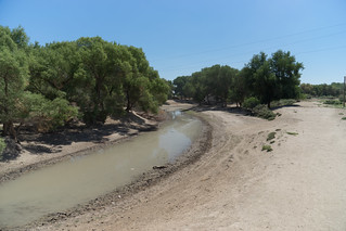
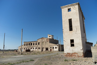
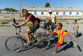
After taking the train to Kungrad, Uzbekistan, Lindsey and I biked the 90 kilometers to the town of Moynak, which once sat on the shore of the Aral Sea. Our ride to Moynak intersected with several canals, which appeared to bring a feeble amount of the Amu Darya’s final water to the town. These canals kept the surrounding landscape from being entirely barren – we saw pockets of water and green bushes instead of pure desert. The town itself follows a long road, as it used to jut out as a peninsula into the lake. It was dusty, with a few abandoned buildings, and at the far end sat an abandoned cannery, where thousands of tons of fish were once processed every year.
It was over 100 degrees F when we arrived, and we bought some water at the one store we found, where several of the packaged items we inspected were expired. We struggled to find food to eat in town – there appeared to be only one store (we later learned that there were a number of small stores, but they weren’t labeled, as they aren’t set up for outside visitors). We also didn’t trust the food at restaurants, as the water supply isn’t good, and intermittent electricity means that refrigeration is sometimes lacking. The town has one hotel, which cost $8 per person per night. We had hoped to stay at the one homestay mentioned in our guidebook, but we learned that the police had shut it down (we’re not sure why).
We hired a guide, a man who spoke English and has lived in Moynak his entire life. He told us he didn’t like the criticism his town receives, and that it actually has a good community that supports itself – it isn’t the ghost town suggested by some journalists. Following him around Moynak, we found more stores where we could buy food (and vodka), as well as a treatment station built by the French where people get drinking water for a few hours every day. He also said the population was growing and not shrinking, as it did after the collapse of the fishing industry.
I asked our guide what the biggest problems were in Moynak. He said “water, weather, and unemployment,” in that order. Moynak is literally the last town to get water from the Amu Darya River, and by the time the river reaches town it is too salty and contaminated, as it has already been used by millions of people upstream. As for weather, our guide explained that it was too hot in summer, with horrible dust storms, both of which are a result of losing the sea. And of course, there isn’t much work in the town – the fishing industry collapsed long ago, as did the cannery in town.
In our reading of the literature on the Aral Sea, one topic that comes up over and over is how increased dust from the old sea bed – contaminated with toxins from industrial agriculture – has led to cancer and respiratory problems. Rates of childhood pneumonia are higher in this region than anywhere else in the former Soviet Union. We asked our guide about this, and his response was interesting. He said that yes, there were health problems, but that the media made it sound worse than it was.
One scholarly paper we read listed the health effects of losing the Aral Sea, but then also noted that the most serious health issues “are directly related to Third World medical, health, nutrition, and hygienic conditions and practices.” In other words, while changes in air quality have hurt the population, the biggest problems are the same as those faced by any poor population in the world. However, one major reason for the poverty is that the town has lost its major industry – fishing.
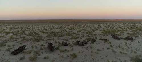
Our guide took us to the highest point in town, a hill that was once a bluff overlooking the inland sea. Stretching out to the horizon was the former lake bed, a flat desert emptiness with a row of rusted boats lining the former shoreline. Our guide told us that this was a holy place: during World War II, soldiers bound for the front lines were bid farewell from that point – and then they sailed north across the Aral Sea. It felt surreal to hear this story and envision parents watching their sons disappear on boats to cross the sea and fight Hitler. Now all we saw was empty desert.
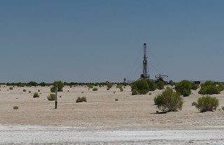
We decided to see what is left of the Aral, so we hired a jeep, and along with our guide and a Korean tourist who also wanted to visit the sea, drove out into the former lake bed. I was surprised to find a paved road, and then pass by gas wells. Apparently, the drying of the lake has made it easier to extract fossil fuels. I asked our guide what people thought about the gas wells. “They’re good,” he said, because they were giving people in the region jobs.
The paved road quickly gave way to a rutted jeep track, and it took three hours on a bumpy road to reach the shore of the sea, where we found ourselves in an isolated, beautiful place in the desert. The water was once one third as salty as the ocean; now it’s three time saltier because the fresh water has evaporated, concentrating the salt (and anything else in the water). We went for a swim after our guide assured us that it was clean enough to do so. Salty water makes you more buoyant, and I almost fell asleep in the water lying on my back. It felt strange to so greatly enjoy a place that I knew was an ecological disaster. That night, we camped on some cliffs overlooking the water, and then woke before dawn to watch the sun rise over the shrinking sea. It was beautiful, sad, and lonely.
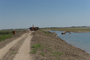
The next day, we drove back through Moynak and our guide took us to where the Amu Darya now ends. A dike blocks its progress, creating a lake that collects the small amount of flow that makes it this far. We were told that there are several projects creating such lakes to provide habitat and some opportunities for fishing. A few bulldozers sat idle nearby. A river with an annual discharge about one seventh that of the Mississippi is stopped by a simple dirt wall.
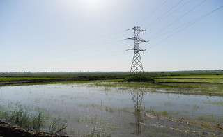
Our jeep drove us to the town of Nukus, where we started biking again, following the Amu Darya upstream. We crossed the river, finding that it had grown in size. And then, as we passed rice and cotton fields, we saw where the Aral Sea has gone. It has gone to agriculture. Whereas Moynak had almost no water, it was everywhere in the upstream floodplain. Families have canals running behind their homes, with verdant gardens in every yard. We’ve heard about many problems with the agriculture that feeds off the Amu Darya – it is hugely wasteful of water, and soil salinization is lowering yields. But after seeing the emptiness of the Aral Sea, it was almost refreshing to see a place with so much life and water.
Based on studies we’ve read (I read much of this book, and highly recommend it), even if agriculture becomes many times more efficient with water use (as it could, especially if they stop growing cotton and rice), the Aral Sea won’t come back soon. It would take too long to refill, and there is simply too much thirsty agriculture. One bright story is the Northern Aral Sea in Kazakhstan, which we didn’t visit. A dam has been built to block off part of the sea. The small lake that has formed now has low enough salinity to support many of the species of fish that used to live there, and a small fishing industry has begun again. But most of the Aral Sea will be gone for many generations. Also, climate change will likely make the return of the sea less likely. Here in the Aral basin, warmer temperatures will cause increased evaporation, meaning that even more water will be needed for irrigation, making it even less likely that the Aral will ever be refilled.
While this journey is named “Ride for Climate,” the tragedy of the Aral Sea is not due to climate change; it has shrunk to a tenth of its former size due to poor water management. However, the Aral Sea serves as a reminder of how dramatically humans are able to reshape the face of the planet, and what happens when the balance of water is changed. Climate change will upset this balance all around the world and require us to improve how we manage water. At the very least, this basin serves as a warning.


