Myanmar II – Hakha to Bagan

February 10th, 2015 by David

We left Hakha around sunrise to get an early start to what would end up being nine days without a shower, bed, or internet, and a diet that consisted primarily of ramen noodles. Shortly after Hakha, the beautiful pavement ended and we spent the rest of the week on dirt. We found few proper restaurants on this stretch, but on our first day we found a nice place called ‘Heaven Cafe’ in the village of Satka. The woman running it spoke some English and went off on her motorbike to get eggs when we asked to have some in our noodles, which was the only thing they sold other than coffee. Like all of the Chin villages we encountered, Satka was strung out along the road, which was following a ridge, so we enjoyed the view and the ambience of the little roadside cafe, where we were the only customers. We camped for several nights in a row, sometimes with beautiful views into the valleys below, and sometimes hidden in thick secondary forest. One night we were close to a stretch of road construction, and the bulldozers seemed to go all night. By this time, we no longer had a full moon so we had to use our headlamps, but we were careful not to shine them towards the road and went undetected every night.

Myanmar 2 - Chin State

One day, we were invited to stay in a village celebrating its Golden Jubilee, or 50-year anniversary. We had stopped to find lunch, and as there was no restaurant we were taken to the pastor’s house and fed there. A young woman who worked at the church happened to speak English and played tour guide. She explained what was happening for the Jubilee and invited us to attend the celebration and spend the night. She also took us to a funeral service for a young woman who had died the night before. We were still in our bike clothes and she marched us right up and into the house where the woman had been laid out in a tiny room, all her relatives around her. I felt so out of place and inadvertently disrespectful until the first person reached out to shake my hand. Then the next, and the next, and I found myself kneeling on the wooden floor, having just caught my first glimpse close-up of a dead person, a total stranger who had died after a long illness, leaving her 3-year-old daughter behind, while her loved ones welcomed us. I shook every hand that came toward me, hoping something in my posture, my murmured attempt at ‘hello’ in the local dialect of the Chin language, would show them my sympathy, my condolences.

Later our friend took us to the big tent where the Jubilee events were set to happen later that day, but we had barely come in when she and another young man told us we’d have to go – the headman of the village was worried that police might come out to the Jubilee from the closest town, Rezua, and that he might get in trouble if we were found there. They could call and ask, she said, and there was a chance they might say yes, but the village authorities were afraid. That was enough for us, and soon we were on our way, although we were sad to miss the celebration. When we got to Rezua we stopped to buy the basics, but nobody wanted to sell us anything. Instead, they wanted to give us things. We managed to pay for some eggs and condensed milk, but the rice and rum we hoped to buy were given to us by smiling women more excited to greet foreigners than to make a buck.

Myanmar 2 - Chin State

We were prepared to camp, but again it was very hilly, with every flat space occupied by a village. We asked a couple outside of their house for water, and then we asked if there was anywhere we could sleep. They smiled and gestured up the hill, and we rode on, uncertain of what they’d meant. When we got to the top of the hill, we found ourselves in the main village, and an old woman greeted us as if she’d been waiting for us. I joked that the couple must have called ahead, but there was no cell reception there. The woman led us to the house of a young woman who spoke English, who then brought us to a large house where an older couple lived. We would stay there, she said, and also pointed to a cistern out back, indicating that we should wash up. After so many days on a dirt road, she had a point. We cleaned up as best we could while remaining fully clothed, and also washed our bike clothes as we were now down to one outfit each. We made our ramen, then hung out briefly with the couple. They made no effort to communicate, but our beds were laid out in their living room so perhaps they were just going about their normal routine. We shared some chocolate and looked at family pictures, and then everybody went to bed.

The next night we stayed in another village just past Matupi, one of the larger towns in the area. Although there were police in this town, and a military camp nearby, Chin State overall felt so remote that I had lost my fear of the police, as long as we weren’t in big towns that had police stations. The headman of the village waved us down as we went through his village near sunset. Again, it was like they were waiting for us. He invited us to stay in another family’s house where we were served dinner. They ate after us, which made us sad as we would have liked to eat with them. (It also would have given us a better idea of how much food they had, so we wouldn’t overeat and inadvertently leave them with too little, which was something we worried about.) However, we weren’t lonely – the headman and two teachers, all of whom spoke fairly decent English, talked with us all evening. The headman told us his brother was a refugee living in New York – apparently he had angered the soldiers from a nearby military camp for protesting their destruction of a cross, and had to leave.

Before leaving us for the night, the headman brought out a big register book and asked us to write down our names and the date. He told us he would let the authorities in Matupi know that we had stayed there, and suddenly I was afraid again. “Are you sure that’s OK?” we asked. We had heard that local people often don’t know the rules related to foreigners, and we were worried he and the family who hosted us would get in trouble. We also preferred to stay off the authorities’ radar, just in case we weren’t supposed to be there. He said it was fine, though, and we didn’t really have other options. So we registered ourselves and hoped everything would be fine. With respect to the authorities in Chin State, everything was fine; with respect to my belly… not so much. I woke up in the middle of the night feeling feverish and sick to my stomach, and only felt slightly better in the morning. Fortunately the family had one of the nicest outhouses I’d seen in Myanmar, and with the help of some Cipro we were on our way.

Myanmar 2 - Chin State

We camped the next night with a few construction workers, and the following night we found a beautiful spot just past a small village where we’d stopped to refill our water bladder, fuel bottle, and flask. The woman running the ‘store’ didn’t seem to have a firm grasp of mathematics or business, so I tallied up the bill after coaxing the price of each item from her. David spent that stop trying his hand at the stick-and-wheel game that I believe was popular in the US in our grandparents’ generation, and is still ubiquitous in developing countries. It’s harder than it looks, but he provided great entertainment. We enjoyed more beautiful views on what turned out to be our last night camped up high.

Myanmar 2 - Chin State

Myanmar 2 - Chin State

The following day we passed through the large town of Mindat and saw our first tourist since Hakha. We also saw women with tattooed faces, an old practice – perhaps to identify them as members of the Chin tribe in case of kidnapping by other tribes – that seems to be dying out, as only older women had the tattoos. The night before we had climbed up to the highest point of our route through Myanmar, 2700 meters, and now we were on our way down. Unfortunately it was now David’s turn to feel sick and he couldn’t really enjoy the looping, paved descent. We cycled out of Chin State and soon started seeing Buddhist stupas again instead of churches. We stopped in a valley village to get water and camped off the road not far from some sort of temple blasting wailing tinky-tonky chanting music until past our bedtime, then starting up again before sunrise.

The next day we biked to Myit Chay, across the Irrawaddy River from Bagan, an area full of ancient temples and one of Myanmar’s most popular tourist destinations. A bridge crosses the river a bit to the east of Bagan, but crossing it would have added over 20 kilometers to an already long day. Plus, Bangladesh had taught us that where there are towns on two sides of a river, there is usually a boat. We started asking around, and sure enough we were told that we could get a boat in Myit Chay. When we got to the town, we asked some friendly men where we could find a boat, and they said to turn left, go for one or two miles, then turn right again and go for another one or two miles. Simple enough, we thought.

On our way to the river, we encountered a group of people wearing Bogyoke (“General”) Aung San shirts, and a big truck all bedecked with posters. General Aung San is considered to be the father of modern, independent Burma, and is well-loved by most of the population. Internationally, he is perhaps better known as the father of Aung San Suu Kyi, the face of Myanmar’s democratic movement who was famously kept under house arrest by the military junta that ruled Myanmar from the 1960s until very recently. It turned out that the following day would have been General Aung San’s 100th birthday, and his hometown was nearby so they were preparing for a big celebration.

Next, we came across a parade of little girls on dressed up horses, young women carrying platters of fruit, and men driving oxcarts festooned with flowers. It was a procession to a Buddhist site – we’re not sure exactly what for, but we were the only foreigners – and the only spectators – so people stopped and posed for photos and waved and smiled. It was a couple of hours before sunset and the light was just right – I felt like we had stumbled onto our own private parade, done solely for the participants and just happening to have an audience of two, us.

Myanmar 3 - Bagan and Central Myanmar

After a mile or so, we asked a street vendor how to get to the river. The man gestured vaguely onward so we proceeded, but within a few minutes a man rode up to us on his motorbike and indicated that he would show us the way. Thank goodness for him, or we never would have found the river. For about 20 minutes we wound down tiny dirt paths through fields where women were harvesting crops, waving at us as we rode by. Eventually he turned off and pointed us to the last bit towards the river. We’d thought he happened to be going that way, or had a boat, but no, he was just taking time out of his day to show two strangers the way. We thanked him and continued on, and soon found ourselves at the shore of the Irrawaddy River.

A group of intoxicated young men were sprawled around a volleyball net, and when we asked about a boat they enthusiastically indicated that yes, they could take us. Nyaung-U, the main town near the temples, was directly across the river, and they offered to take us there for 5,000 kyat (~$5). But we wanted to go to Old Bagan – the main temple area, and a bit farther downstream – so we could see the temples from the water at sunset, and this seemed to confuse them tremendously in their drunken state. I thought it was a language thing, but soon a man arrived on a motorbike who spoke good English. He translated, and it seemed that they understood, but would charge 15,000 kyat to go all the way to Old Bagan. No problem, we said, let’s go. But then they put us on the boat going to Nyaung-U. Confusion reigned, and we weren’t sure we wanted one of these wasted men to pilot us and our bikes across the river. Then another boat arrived, and the boatman seemed sober.

He seemed to understand our request, so we pulled our bikes out of the first boat and walked to his. All seemed to be going well until one of the drunk men, who we nicknamed ‘White Skull’ for the logo on his t-shirt, hopped in. No, we said, we want to go with the other man, the one who is sober. So sober guy hopped in, and nodded solemnly when we indicated that he was to drive. White Skull fired up the engine, and again we pointed to sober man. Again he nodded, and moved towards the back of the boat, but when I looked back, White Skull was driving, grinning away. We figured he couldn’t do too much damage, and if he started to steer us astray we’d have sober guy take over. White Skull got us safely to shore, and we got our first glimpse of the temples as the sun set over the river. Then we biked to Nyaung-U – where we actually planned to stay – and found a nice hotel, one of the most expensive of the trip, but we didn’t care. Unbeknownst to us, another bout of GI problems was settling in, and we needed to rest.

Myanmar 3 - Bagan and Central Myanmar

Bagan was an interesting place, but due to being sick and exhausted from our crazy ride through Chin State, we spent most of our time there relaxing at the hotel. We got out to see the temples a few times, always on our bikes, and we joined all the other tourists for sunset at Shwesandaw Pagoda. Bagan is probably the most visited place in Myanmar, and we certainly saw more foreigners there than anywhere else in the country, but somehow it didn’t feel overrun. There were still monks strolling around, and local people seemed happy to talk to us. There was western food, which we appreciated with our weakened stomachs, and decent ice cream if you looked hard enough, and people hawking art and trinkets at the major temples. Still, Nyaung-U felt like a sleepy town that just happened to have a thousand or so temples scattered around it. There was an entrance fee of $20 for the whole site, but they only checked tickets at the major temples. At smaller ones we were usually the only tourists there, and gatekeepers would let us in to roam around while kids played soccer outside. We stayed one night longer than intended, waiting for our stomachs to recover, then rode out of Bagan, aiming for the coast.

Myanmar 3 - Bagan and Central Myanmar


Myanmar I – Tamu to Hakha

February 5th, 2015 by Lindsey

We arrived in Moreh, the border town between Manipur and Myanmar, around lunchtime. Our permits just had arrived by email, so we found a place to print them out (even though we had been assured that a copy had also been sent to the border post). Then we ate lunch at a typical ‘rice hotel’ – a common name for lunch spots in Northeast India – where we were approached by a man with a thermometer who told us we had to have our temperatures taken to ensure that we didn’t have ebola. They wouldn’t let us into Myanmar otherwise, he said. So we got our temperature taken and received a certificate indicating that we were healthy, and then proceeded to the border.

We had a little trouble finding the Indian checkpoint – it was a much bigger building than at the border with Nepal, but it wasn’t clearly marked and there were no other travelers there. Once we found it, we had to track down some officials, who, after digging up an ink pad and some stamps – apparently not a lot of foreigners cross here – checked us out of the country. We then rode through a no-man’s-land of burning garbage piles before crossing a bridge and seeing the sign reading “India-Myanmar Friendship Highway.” After all of the planning, reaching the Myanmar border felt particularly momentous. We parked our bikes on the street next to a steep staircase leading to the customs building. This was it – the moment of truth. Would they let us in? A bored-looking man in a blue lungyi (sarong) told us to sit, then fetched the permits that the travel agency, Seven Diamond, had sent to him. It all seemed fairly routine, like they let foreigners cross every day, which felt contrary to our experience getting out of India, just across the river. We began to suspect that the permit wasn’t even necessary and it was all a racket to squeeze extra money out of tourists. He stamped our passports and wrote in the 30 days we were allowed to stay. Nobody had appeared to collect our money and we thought we might be able to just leave, but he told us to wait for our ‘guide.’

Eventually a young man with a mouth stained red from betel nut appeared on a motorbike, and we were released into his care. He didn’t ask for money, just motioned for us to follow him, so we did. We rode a few kilometers to the border town of Tamu, where he said he’d show us to our guesthouse. We weren’t expecting this, and we asked if we had to stay there. He told us we were free to stay anywhere we wanted, but first asked for the $200 we owed him for the permits. We handed it over (two crisp $100 bills saved for this very purpose) and rode around the town, which consisted of a few blocks on each side of a T-section. With some difficulty we accomplished our tasks: changing rupees (we were told to look in the market but nobody there could help; instead we found an Indian man at a clothing shop called Mizo, on the main road about half a kilometer past the turnoff to the market) and getting a SIM card (there were lots of places selling them in the market, but we never could get the data to work!). We looked for a cheaper guesthouse, but only saw one hotel that looked so unpromising we didn’t even check. We went back to the first place, had dinner at a “beer station” (after months in countries where alcohol was hard to find, and rarely available at restaurants, we decided we were going to like Myanmar), and turned in.

Myanmar 1 - Sagaing Region

The next day we biked towards Kale, about 90 miles away. Myanmar uses both miles and kilometers (as well as furlongs, which refer to the length of a furrow in an agricultural field, and are 1/8 of a mile), and sometimes people use the terms interchangeably to refer to the same distance. This caused us a few navigational problems during our time in the country. We took a long lunch break, enjoying the leisurely feeling of this very relaxed country, and we didn’t make it to Kale that day. Near sunset, we went through a village and stopped to watch some guys playing chinlone, a local sport similar to volleyball in which small teams use their feet, heads, torsos – anything but their hands – to get a small rattan ball over a net. We made sleeping motions and gestured around, but people just pointed us down the road. We asked at several more places, following their outstretched hands; the place they pointed us to may have been an official’s house, but the people inside just stared at us. We had already gotten water, so we figured we’d test our luck and camp.

Almost every cyclist’s blog in Myanmar has stories of being discovered by the police and forced out of their campsites, so we knew we’d have to be stealthy. The area was pretty heavily populated, though, and all of the paths off the road led to fields and houses. Finally we decided to just strike out through an empty field, not following a path. We raced off the road when there were no cars coming by and crashed through the bushes; after a while we found ourselves in a harvested rice paddy with a couple of buffalo staked nearby, well hidden from the road. We pitched our tent and made dinner by the light of the full moon – we’d read on another couple’s blog that they never used flashlights when camping to avoid detection – enjoying the chirping crickets and comfortable site.

The next day we made it to Kale in the early afternoon. We met Guillome, a French Canadian traveler who had spent about a month in Myanmar. He’d been having a great time, taking boats and buses through Shan state and in the far south after crossing over from Thailand. He taught us that a hand waved vertically by your ear means ‘no.’ We had lunch (with beers) and dinner (with more beers) at a Chinese restaurant down the street from our hotel, where we were excited to speak Mandarin with the owners.

We left early the next morning and biked out of town, immediately beginning our climb into Chin State. The guidebook said some of the state was recently opened to foreigners, with the rest, presumably, still being closed. Seven Diamond, the agency that had arranged our border crossing permit, said that the capital, Hakha, which was about a third of the way down our intended route, was open, but that the other two towns we’d asked about farther down the road required a permit and guide. We figured we’d just go as far as we could and see what happened.

We climbed 2000 meters that day on a good paved road. Near sunset a young man on a motorbike passed us and asked, in his limited English, the usual questions – Where are you going? Where are you from? How do you like our country? – and invited us to stay at his house. We were thrilled, since the steep terrain meant camping would be difficult, but then he said his village was seven miles away. We were still going up, and we wouldn’t be able to make it by dark. So we promised to come to his house for breakfast the next morning, and, in the next village we encountered, asked at a church for a place to stay. David had barely mimed the sleeping motion and the old man was waving him in, pointing to a mostly-empty room.

We were a little wary of staying with villagers – we’d heard it’s illegal and that, while we probably wouldn’t get in trouble, local people who hosted us might. Since it was nearly impossible to camp, we thought a church might be a good bet as a last resort, since it wasn’t anybody’s home. Well, this church turned out to be attached to a home, and the family that lived there (presumably the pastor’s family) invited us to eat with them and later treated us to a sing-along concert that was crazy magical. Dinner was rice and some sort of green vegetable, cooked over a wood fire in the middle of the room. No chimney meant a smoky room, and the dim, battery-powered light coupled with the cooking fire and smoke and total lack of shared language made for a shadowy, quiet, sacred-feeling meal. This was the poorest family we stayed with on the whole trip, I think, and we tried to explain that we had our own food and didn’t need to eat theirs, but they weren’t having it. We then tried to share a plate of rice and not take much of the vegetables, as we’d had a good lunch, but again, no dice – they kept piling food on our plate and urging us to eat, and eventually, we complied.

Myanmar 2 - Chin State

Myanmar 2 - Chin State

The family consisted of an older couple, their son and daughter-in-law, and their three children, a teenage girl and two little boys, four and five years old. We ate in shifts around a low wooden table, sitting on tiny wooden benches a few inches off the ground. The girl ate last and alone, and as she did she occasionally burst into wild-sounding guffaws. Later I heard the same noise a few times in the middle of the night. She kept to herself, staring intently at nothing and not talking to anybody, and I think she must have had some sort of mental illness that affected her communication and behavior. The two boys were always by the side of their mother or grandmother, and the youngest, once he got used to us, kept sneaking big grinning glances at me. After the singing, they laid out a mat and a few blankets for us on the floor of the church room, then went to bed in a room next to the kitchen. In the morning they served us mugs of a hot cereal, and after efforts to convey our gratitude that could only fall short, we were on our way.

As we rode, we asked for the village of the young man from the night before, but we never found it. I do think I saw him though, out of the corner of my eye as we were descending, but it didn’t register until much later and I felt badly that we hadn’t stopped. However, later that morning we made another friend and went to church. After about ten kilometers we stopped in a village and tried to find a restaurant to supplement the cereal we’d eaten. A young woman who spoke good English took us to the only restaurant in town, but it was time for church and the owners didn’t have time to make breakfast for us. So the woman invited us to her house and made us scrambled eggs served with rice. We got out our coffee and had a nice breakfast. She’d learned English working as a maid in Malaysia, apparently a common things for girls in the area to do. She told us that some people are so poor that they don’t have enough food, so they send their daughters abroad to work. This unfortunately is often what happens when people get caught by traffickers and sold into an altogether different line of work.

This young woman had gone with an agent when she was 14 and worked for four years. Now she’d been back for a while – she was 23 – and was married with a 6-month-old son. She went to a different church than the restaurant owners, and we asked if we could attend the service. It had been years since I’d been to church, and I think the majority of my attendance as an adult has been outside of the US, meaning I rarely understand the services. Here, it didn’t matter. The Chin Baptist church just about converted me back to Christianity. Like the singing the night before, it defies description. We were both in a strange mental space – I’d gotten angry with David for not trying harder to find the motorbike man, and I think we were also just worn out from the road. I think our nerves were truly raw. Everything touched us, one way or another, and I was never far from tears those first few days in Chin State. Whether it was mystical chanting in a smoky room, our own attempts to sing Amazing Grace (at our hosts’ request – they were not impressed), the voices of a youth choir filling every corner of the chapel, a failure to keep a casual promise, or the beautiful contour of the road around the mountains, it just got to me.

After church we started riding again, up and up, and found a place to camp between bends in the road where the land had been cleared, probably for firewood to heat the tar used for road repairs. There was a lot of roadwork going on in Chin State – repairing the dirt roads from the landslides that must happen every rainy season, and widening and paving some stretches – with mixed-gender crews and entire families living in camps along the road. We were awoken before light by somebody firing up the tar fires, but he probably didn’t see us and we went back to sleep. The road crew arrived just as we were packing up, and when we started carrying our stuff up the sleep slope to the road, one of the men spotted us and rushed down to help us. The women all giggled at us from under their straw hats, no doubt wondering what on earth we were doing there, and we felt like the day had gotten off to a nice start.

Myanmar 2 - Chin State

Myanmar 2 - Chin State

We thought we might make it to Hakha that day, but people kept saying it was 20, then 15, then 13 miles away – too far to make it before dark. So we found a nice place to camp, but we hadn’t filled up our water bladder since we’d hoped to make it to town. We decided to use our water to make noodles for dinner and have breakfast in town; we were not happy campers the next morning. Still, the campsite was great – set well back from the road with a nice view of the surrounding valleys. We heard lots of gunshots from local hunters, and later we heard yipping and howling that was probably the local version of coyotes but sounded like tormented ghosts to me.

The ‘miles’ people had told us about turned out to be kilometers, and as we rolled into town early the next morning, we were frustrated to realize that we could have made it to Hakha the night before after all. A very kind hotel manager let us nap and shower in one of his rooms for free, and we also did some laundry. First, though, we ate a giant breakfast, and later a big lunch. It was getting later and later, and as we rode out of town around 4:00 David decided he needed to check email to set up some book events, try to arrange a talk in Yangon, and let our parents know we were alive. Of course the Internet place was down hill in the wrong direction, and by the time we finished it felt stupid to leave. So we ended up spending the night and had dinner with visiting World Vision workers, including an American who told us who had won the Super Bowl, days afterwards. David was thrilled; I wished we could have avoided hearing the news…


Back to India: the Northeast

February 3rd, 2015 by Lindsey

A trip of this length and variety gets integrated strangely into the psyche and memory. Time stretches and contracts—Turkey feels more present sometimes than, say, Nepal, and I wonder if it’s because everything was so fresh and new then. Every event, each new place, person, or experience, warranted a reaction; we talked about it, processed, reflected, wrote. When we realized the other day that there was about the same amount of time remaining in our trip as we had spent in Turkey, we were both alarmed to realize how long that time seemed when we were there—and how it doesn’t seem like much time at all going forward.

Our points of reference for have become other parts of the trip, rather than our lives in the US. When I’m hungry, I’m just as likely to fantasize about Georgian katchapuri as a Mission burrito; the absence of alcohol in Bangladesh reminded us of Turkey; when we couldn’t find Internet, we reflected fondly on China’s ubiquitous Wi-Fi (though we didn’t miss its censorship). One element we find repeating from country to country is being able to predict what people are going to say to you and having fun pre-empting them. In Uzbekistan, we could tell somebody was going to ask us where we were from before they opened their mouth. In Russian, this question is boiled down to one word: “Atkuda?!”, often preceded by a grunt. This question was shouted out at us constantly, everywhere we went, with no greeting or follow-up, expect the occasional, wide-eyed “Ooh, America!” At times, weary of the constant “Uhh! Atkuda?!” I would beat people to the game, turning and yelling “Atkuda?” to them before they had a chance to ask me. This practice, which I called “Atkuda’ing” somebody, always resulted in everybody having a good laugh and distracted me from the weariness that long-term travel can create.

In India, the conversation was a bit longer and often included a photo op, and was played out many times a day with men on motorcycles who would roll up alongside us as we rode along the highways of Bihar, West Bengal, and the more populous parts of the Northeast. One day, in the flat plains of Assam, David “atkuda’ed” a pair on a motorbike, inverting the entire standard bike-touring-in-India conversation. Before the men could ask us questions, David asked, “Where are you from?” “Silchar,” they responded. “Oh, very nice. We liked Silchar. Where are you going?” “What is your name?” The guys answered politely and were put off for a moment, perhaps forgetting that they were the ones with questions, and they rode quietly behind for some time before pulling alongside us again and asking those very same questions back, as we’d anticipated.

India 4 - Assam

Auto-repeat conversations notwithstanding, we’ve enjoyed the Northeast immensely. It doesn’t feel like India—this isn’t to say we didn’t enjoy the “mainland” for its own merits, but I will admit that we’ve found the Northeast to be far more relaxed and comfortable than Bihar or West Bengal. Perhaps most striking is the population density. When we crossed from Bangladesh into Tripura, we immediately felt like we had more space. Agartala, the Indian border town, was laid back and friendly—I walked around by myself after dark for the first time in weeks, and was delighted to notice other women, with families and unaccompanied, out in the streets. Going out alone wasn’t forbidden in Bangladesh, but it was strongly discouraged in Bihar, and I’d just gotten used to not really leaving wherever we were staying after dark. In Agartala, I’d been running errands alone for about half an hour before I realized how novel it was to be out and about without David, especially at nighttime.

After leaving Agartala, we started climbing almost immediately. They were modest hills, around 200 meters, but as we rode higher we noticed in astonishment that we were the only people around—the hills were covered in protected forests and there were no settlements, just the occasional paramilitary camp. I should note that paramilitary is the term for government armed forces outside of the regular army, tasked mainly with domestic issues. In the Northeast, these issues are extremists, or Underground Groups (“UGs”). When we read the Lonely Planet’s section on Manipur, the state that shares a border with Myanmar, we learned that it is “… by far the most dangerous state in the Northeast.” It goes on to say that foreigners are only allowed in the capital city of Imphal, and even then you need a special “Inner Line Permit.” Fortunately we’d consulted more recent sources, which said that you no longer needed this permit. We also asked police and paramilitary we encountered along the way, who all bobbed their heads side to side and said “safe, safe” when we asked about the road ahead. Several people, though, cautioned us to get off the road before dark and to stay in hotels rather than camping. So we took their advice and spent a few nights in hotels of varying quality as we rode from Agartala to Silchar, the last proper town before Imphal, several days away.

India 3 - Tripura

One night we stayed at a guesthouse that advertised “fooding and lodging,” one of many amusing phrases we’ve encountered in India. And at that hotel we indeed felt “fooded” when we sat down in the hotel’s restaurant and within seconds, before we had a chance to order, plates full of rice, dhal, and vegetable curry were plunked under our noses, with a man vigorously wielding a ketchup bottle close behind. Another night, we were woken at 4:14 AM by dueling “music” emanating from nearby temples. Some other people in our modest cement cellblock hotel were also up, and we asked them what was going on. They shrugged. Still half asleep, David asked in distress, “How is this OK???” I consulted the Internet to see if there was a Hindu holiday, but found nothing. Fortunately, David remembered that he had an album on his computer titled “Natural White Noise for Babies: Help Your Baby Sleep Through the Night,” which he’d downloaded when stranded overnight at an airport. We put it on repeat, and, like babies, we slept the rest of the night despite the high-volume performances down the street.

After five relaxed days of riding in Northeast India we reached Jiribam, the town on the Manipur state border. While the police at most other checkpoints had casually waved us through, this one stopped us and directed us inside a small hut on the side of the road. They got out a form, layered it with carbon paper and additional sheets, and filled out all of the details from our passports. We held our breath as they took down David’s information, as there was an error in his visa that had given us problems before. Nonetheless, they completed the paperwork without incident and called in a well-dressed man to stamp and sign our passports. A state stamp! This was new. The man directed us to report to his headquarters in Imphal, the state capital, but despite efforts to clarify I didn’t know if this was mandatory or a mere suggestion. We ended up not registering anywhere in Imphal, and nobody ever asked us about it as we rode to the border with Myanmar, so it must not be required. During the process they served us delicious tea and snacks—some of the best samosas we’ve had—and also called a hotel owner for us. We had heard there were no hotels in Jiribam, so we were relieved when they told us there was one. Well, it turns out there is an entire block of them, so we could have just ridden down the road and taken our pick. However, at 300 rupees (about five dollars) our room was reasonable, and we liked the owner, a young guy who spoke good English and thought our bike trip was crazy, but admirable.

We also asked the police about the road ahead—both about extremists and places to stay. They repeated what we’d heard before: the road was safe during the day, but find somewhere—with security, our hotel owner added—to sleep inside at night. I had looked at Google Maps back in Dhaka and plotted out distances between the towns that showed up on the map. It was 89 km from Jiribam to the first town, then 49 km and 64 km. The road was in bad shape, though, and we were happy to learn that there was a small town called Barak with a paramilitary station about 75 km away. So we made that our target and had a serene day of riding, first up a mostly paved road to the friendly town of Kaimai, then a beautiful 20 km descent, right at the perfect time for riding—an hour before sunset when the air is cool and the light is sublime—sailing downhill through bamboo-covered mountainsides.

India 5 - Manipur

When we got to Barak, we started asking around about a place to sleep. The townspeople immediately directed us to the paramilitaries, who were flustered at our sudden appearance on bicycles, without a word of Hindi between us. They called their commanding officer, who got up from his post-patrol nap and strode down the walkway in a blue Adidas track suit to meet us. He spoke decent, distinctly Indian, English, and invited us up to a little gazebo and asked to see our passports. He asked for our names and phone number, what we needed, where we were going, and whether we wanted tea or coffee. We told him we were on our way to Imphal, and he startled us by saying “That will not be feasible.” Soon, though, we understood that he was telling us we couldn’t go on that night. We agreed and told him that was why we had stopped in front of his station—we needed a safe place to sleep, and wanted to know if we could pitch our tent in their camp for the night. Of course, we could not camp, he said, and he wasn’t allowed to let outsiders stay there, but fortunately none of his superiors were on site, so he would gladly make an exception and host us. And host us he did—we had a delicious dinner, with chicken curry made just for us (he is Hindu, and a strict vegetarian), rice, dhal, and chapati. He brought out a bottle of whiskey and turned on the TV. We watched Bill Bilichek’s Deflate Gate press conference, and then Schwarzenneger’s “The Last Stand.” Or, rather, David stared blandly at the television, distraught over the Patriots’ scandal, while I told our host everything he wanted to know about the US. He asked whether we had anything like the caste system—social classes based on race, location, or income—and I was so excited to be straying from the usual “Where are you from? Where are you going?” conversation that I talked his ear off about how America is based on all these great ideals regarding equality, but that there are still huge problems around race, class, and inequality. It’s probably not what he was expecting. I also tried to use this opening to ask questions about caste, but it is still a big mystery to us.

India 5 - Manipur

We spent the next night in great luxury—we arrived at a small village near sunset, and after we found somebody who spoke English, we were directed to a nearby Catholic Church. We rode down a steep driveway past some friendly teenage boys playing soccer, and when we got to the church’s porch, a young man welcomed us and went to get “Father.” Father William appeared, beaming, and introduced himself. We explained our situation and he immediately led us upstairs and showed us to a room with two beds and a bathroom. It felt as if he was expecting us; the church has a few guest rooms for visitors, and we had one of our most enjoyable and comfortable nights in India. We had dinner together after Father William said grace—we felt lucky to receive a blessing from a priest, especially when he asked for a safe journey for us—and we peppered him with questions about Catholicism in India and the history and present status of the Northeast.

The conversation was greatly enriched by the fact that he speaks perfect English (as well as four other languages) and did his PhD on the socio-economic history of his tribe, the Mao Naga. It was another one of those surreal moments—who would have thought that we would stumble upon a penta-lingual Catholic priest historian in the middle of Manipur, a place we’d only heard of a few months before as we charted our route, described only as “green, mountainous, and dangerous.” Father William runs a school for children in his parish, which helps explain why so many of the young people in the area speak such good English (often they shyly say no if you ask whether they speak English, but proceed to answer all your questions clearly). It was fascinating for us to talk with this man who is so committed both to his Western-origin religion and to the preservation of his Naga culture. I read the last chapter of his dissertation, which helps explain how the two aren’t necessarily at odds; it speaks of eco-spirituality, invoking Christian principles to preserve the land, and also discusses how Christianity needs to adapt to the local context, both to bring people over to the faith, and to become more relevant and serve them better.

India 5 - Manipur

He never asked our religion; we both grew up in nominally Christian families, but are no longer practicing and if asked for one word to describe our religion, would probably say “agnostic.” Nonetheless, after nearly nine months in Muslim, Buddhist, and Hindu countries—with the exception of Georgia—it felt good to be among Christians, something I never thought I would say as I don’t really identify with the faith. He showed us into his church, and while I feel and appreciate the beauty and holiness of mosques, temples, and stupas, there was something comforting in the familiarity of this church—the modest wooden benches, high ceiling, and alter, covered in traditional cloth but adorned with symbols I recognize from my long-ago church-attending days.

The next day, we gave ourselves a nice, slow morning, since we were ahead of schedule to arrive in Imphal—a rare occurrence that we savored. There was more climbing, but the road was in excellent condition and we made decent time. Still, we were 30 km short of Imphal around 4:00, the time we needed to start looking for a place to sleep. We stopped in a small village where a young man at a store told us the area was safe and that we could stay in the village that night if we needed. We then encountered an older man who said there wasn’t anywhere to stay in the village, but that there was a military post two km down the road. We proceeded to the military post, but it wasn’t very welcoming, set on a barren hillside behind rows of barbed wire with stern-faced soldiers at the gate. So, we did something we almost never do—we turned around.

As we approached the village for the second time, we stopped to greet a man and woman walking up the road. “Welcome,” said the woman, extending her hand. When we asked about a place to sleep, she pointed down the road and said there was a guesthouse. We walked back into the village together, where we again met the older man, who raised an eyebrow and asked why we hadn’t stayed at the military post, as there really wasn’t anywhere for us in the village. Normally this would have made me uncomfortable—I hate forcing myself on people, demanding hospitality, but there was something so relaxed about the place, the music wafting out of one of the houses, the welcome we’d received from everybody else. So we just smiled and let our new friend talk to him, and within a few minutes he’d disappeared, then reappeared with a set of keys.

He unlocked a room next to the market, and voila—two wooden beds, room for the bikes, the perfect home for the night. We spent the rest of the evening with our new friend and her daughter Tracy, who visited us, along with all her friends, before and after bible study. We’d landed in a Kuki village. As we learned later, most of the villages at the tops of the mountains in Manipur are Kuki, and they are Baptists. Tracy and her friends watched us cook and eat our noodles; they showed us their bibles, written in Kuki, and one of her friends shared that his dream was to preach the gospel. He asked us our favorite bible verse and I think our poor Christian credentials showed when we couldn’t answer. It was a lovely little town of about 190 people, with adults and children drifting in and out all evening. The next morning, our nominal host knocked on our door at 6:00 to say goodbye before boarding an auto-rickshaw to attend a meeting. Later, after another meal-with-audience, we bid our friends farewell and rode the rest of the way to Imphal.

India 5 - Manipur

In Imphal, we were hosted by the members of Pedal Attack, a local cycling group that hosts travelers through WarmShowers. David interviewed a few members, and you can learn more about their group here (https://www.facebook.com/Pedal.Attack). They took us all around, showing us Loktak Lake, the War Cemetery, and a local Hindu Temple.

After three days, we left Imphal for the final push to the border. We got a late start after changing money (we needed dollars for Myanmar, as well as rupees, which we’d heard you could change at the border), going grocery shopping, and getting a few bike parts from our friend’s store. We rode 50 km on the perfectly flat plain that surrounds Imphal, and then started climbing. At 4:15 and 1200 meters in elevation we found ourselves in another Kuki village. We asked some teenage girls at the local shop about a place to stay, and before we knew it we were sipping tea with them. They put us up in the shop owner’s house, and we made dinner as they looked on—they told us they only eat twice a day, at 8:30 in the morning and 4:30 in the afternoon, and that they weren’t hungry. Still, we felt a little strange eating in front of them, but they were busy texting friends and listening to music—we discussed Justin Bieber and Miley Cyrus and played music for each other on our smartphones. Afterwards, we shared some chocolate with them and went to bed.

India 5 - Manipur

Kuki people get up early, and so did we, but with all the farewells we didn’t get on the road until almost 7:00. We were further slowed by the many checkpoints as we approached the border with Myanmar. At several points we were required to dismount and hand over our passports. Data was entered, supervisors called, and then we were waved through. At the last point, we were subjected to a lengthy interview by one “Major Rocky”. We concluded that he must be terribly bored—in addition to our passport details, he asked—and recorded—every country we’d visited, interjecting his own commentary and asking extra questions. How did we like Indian food? Did we like Obama? So did he, but until recently Putin was the bigger man. What is our profession? Ah, environment! There are other ways to save the environment, in addition to cycling, no?. We met another traveler later who had a similar experience, though he was also treated to the Major’s entire regiment parading and saluting. We felt a little cheated.

In the border town of Moreh, we printed out our permit to cross the border, which had arrived in an email earlier that day. We had lunch, then crossed our fingers and cycled to the final checkpoint. Actually, it wasn’t that straightforward. First we were accosted by a man with a thermometer who insisted he needed to take our temperature to make sure we didn’t have Ebola (we didn’t). Then we had our passports inspected by another military official at the “land customs office,” and then we nearly missed the large white building by the side of the road, where upon our arrival a surprised-looking man, neatly dressed in a button-down shirt, rustled up some stamps and ink (he had to fetch a backpack from another room) and stamped us out of India, taking no notice of the extra “2” in the passport number of David’s visa. In another room we filled out a customs form, and then biked the remaining kilometer through no-mans-land to the bridge that would take us to Myanmar.

India 5 - Manipur


Photos from Northeast India

February 1st, 2015 by David

After leaving Bangladesh, we cycled through three of Northeast India’s states. Below are the best pictures from this two weeks of travel. You can also look through more pictures in the Flickr albums of each state with these links: Tripura, Assam, and Manipur.


In Northeast India… and Behind on Blogging

January 25th, 2015 by Lindsey

I’m writing this from Imphal, a city in the far northeast of India. We are a bit behind updating this blog — in the past month we’ve crossed Bangladesh and five states in India, where we have had very limited Internet connections. We have many photos to upload and drafts of several blog entries, but it will be a bit longer before we can post them — check this site in a few weeks to see what we’ve been up to.

In the meantime, you can see (some) pictures on our Flickr page, or see updates on Twitter or Facebook. We are also regularly uploading our rides to Strava — you can follow us there for details about each day’s ride.

We are nearing the end of our journey, and our minds are turning towards getting home. We have tickets to fly out of Yangon, Myanmar on the 2nd of March, meaning we have only a bit more than one month of travel left!


Bangladesh – Photos

January 19th, 2015 by David

Below are our favorite photos from a few weeks in Bangladesh. You can also see more photos on our four flickr albums of cycling the country, The Delta, Boat Journey to Dhaka, Dhaka, and Dhaka to Agartala.


Dhaka

January 18th, 2015 by Lindsey

We rushed from the Sundarbans to Dhaka in order to attend the Gobeshona Climate Change Conference. This conference, organized by the International Centre for Climate Change and Development (ICCCAD) and held at the Independent University of Bangladesh, gathered people from all over the world doing research on climate change in Bangladesh.

Bangladesh 2 - Boat Journey to Dhaka

Due to mechanical trouble (one of the boat’s three engines failed), we arrived later than intended, but we still managed to attend a number of sessions, not to mention meeting and interviewing some of Bangladesh’s major climate change researchers. The conference website has most of the presentations available, so rather than going through details I’ll provide my takeaways here.

It was encouraging to see so many good minds addressing Bangladesh’s vulnerability to climate change. When we were visiting communities near the Sundarbans, it was obvious that the people living there face an array of problems, some of which are related to climate change. For example, people talked about how their usual sources of drinking water—the river and wells in their village—had become too salty or polluted to use. When crossing the Delta, we also heard about how farming had become more difficult in the aftermath of frequent cyclones, including the recent Cyclone Aila. At the conference in Dhaka, we heard from researchers working on salt-tolerant rice and studying the various factors that cause salinity increases in people’s water supply.

Bangladesh 3 - Dhaka

One of the conference’s themes was about integrating climate change adaptation into the general planning process. Before this journey, I worked for several years for the State of California, and learned that even in a developed economy like California, our approach to building and maintaining infrastructure is fractured and inconsistent. I can only imagine the challenges in Bangladesh, where a severely under-sourced government has its hands full just trying to keep its people from starving and constantly trying to recover from a seemingly endless wave of natural disasters. The government of Bangladesh, like many national governments, thinks in terms of five-year plans, while planning for climate change requires a much longer view. People at the conference seemed to think that while progress is slow, there is potential and interest within the government for integrating climate change considerations into their planning process.

We also heard, in casual conversation, about roadblocks to progress. For example, Bangladesh has two major funding sources to help adapt to climate change: the Bangladesh Climate Trust Fund, an internally financed fund administered by the central government, and the Bangladesh Climate Change Resilience Fund, which is funded by foreign donors. Both funds support projects under the framework of the Bangladesh Climate Change Strategy and Action Plan, which is housed in the Ministry of Environment and Forests. While it is encouraging that a Plan and finance mechanisms exist, we learned that implementation is slow—the government, apparently, has not yet put in place sufficient institutional controls to manage funds from outside donors, so some donations have not been transferred to the Fund. In addition, where money is flowing, corruption prevents some of it from making it to its intended project. Cyclone shelters, for example, might be built with only a percentage of the budget allocated them, because corrupt officials along the way pocket sizable chunks of the funds before construction even begins.

Bengladesh 1 - The Delta

In the week before arriving in Dhaka, we saw embankments and levees protecting settlements and fields, and at the conference we learned that the government has been setting aside funds to increase their height. I am skeptical about solutions that rely exclusively on building one’s way out of a problem as serious as flooding, especially when the solution—in this case, raising the embankments that were built to ‘reclaim’ land in the Delta—is actually part of the problem. We learned that the embankments, built in the 1960s to enable people to live and farm in an area that otherwise would flood regularly, also prevent sediment carried by the rivers from spreading out across the land. This has resulted in one to one-and-a-half meters of subsidence compared to the nearby protected area that is not enclosed with embankments. The resulting lower elevation of the land increases its vulnerability to sea level rise and natural disasters.

Both of us have studied climate change literature, and from our reading we gained a wholly dismal picture of Bangladesh, with some articles basically saying that tens of millions of people will lose their homes in the next few decades due to rising sea levels and storms. Bangladesh is the poster child for climate change, especially sea level rise, and it’s no joke. Bicycling across a country is a visceral way to get a feel for its flatness. People already have water problems, for drinking and for irrigation, and whether salinity is increasing due to sea level rise, shrimp farming, groundwater pumping, the Farakka Barrage, or the silting up of the rivers (or all of the above), rising sea level is only going to make it worse.

Bengladesh 1 - The Delta

Moreover, many people along Bangladesh’s coast (and elsewhere in the country) are poor, meaning they’re unlikely to have other options if they can’t grow crops, or that they won’t be able to rebuild if their homes, crops, or livestock are destroyed in a cyclone. So climate change adaptation, or resilience, is about more than seawalls and wells; it’s about basic economic development, and there are some bright spots there. Despite GDP per capita being lower than India’s, Bangladesh scores higher on most human development indicators—they have far better access to basic sanitation, for example, something we again experienced viscerally (in Bihar we saw countless men literally pooping along the road, while in Bangladesh we saw comparatively sparkling bathrooms in people’s homes and roadside restaurants); literacy rates are higher among both men and women, infant mortality is lower, and most people we talked to said that the economy is growing, that life is getting better.

Bangladesh 2 - Boat Journey to Dhaka

And, after biking across the country, visiting the Sundarbans and the Bay of Bengal, and meeting many of the country’s climate change experts, we actually feel dimly hopeful. People, while poor in many of the communities we visited, seem resilient; the government is starting to pay attention to climate change; and the international community is concerned and engaged. While big infrastructure may often only be a Band-Aid, the country’s plans to raise embankments, build cyclone shelters, develop salt-tolerant crops, and promote alternative livelihoods, among other initiatives, could enable people to stay where they are for awhile—to send their children to school, to learn skills that will allow them to thrive elsewhere, and to become better prepared for what is to come.


The Delta

January 14th, 2015 by David

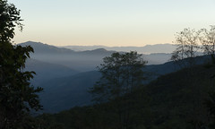
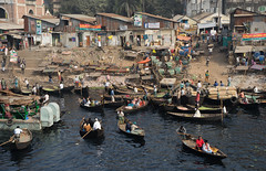
The Ganges Brahmaputra Delta — the “Mouth of the Ganges” — is the world’s largest delta. It has been built over the eons by sediment from the Himalaya, and it hosts the world’s largest mangrove forest, the Sundarbans. It is also home to Bangladesh, a country the size of Iowa with about half as many people as the entire population of the United States.

When we planned our journey, the Delta was our goal, and it was where we’d end our ride across Asia. Since then, we’ve extended our journey, and we will instead finish about a month and a half later in Myanmar. Nonetheless, reaching the Delta still felt significant. For months since leaving Turkey, we had told people we were going to Bangladesh, and now we were there. From a climate change perspective it is also an important destination. Few people in the world are more at risk to rising sea levels and stronger storms than the roughly one hundred and fifty million people living in this mega-delta.

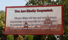
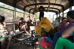
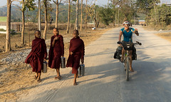
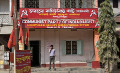
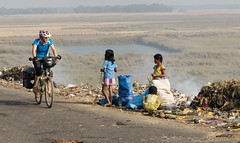
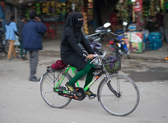
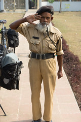
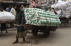
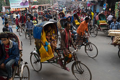
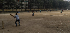
We left Kolkata early in the morning after being interviewed for a local TV station. The reporter and cameraman met us at our hotel at 6:30 am and then followed us for a few blocks as we cycled away from the city’s tourist ghetto. Intermittent rain made the city feel both less and more disgusting—the stray dogs (more than I’ve seen in any city, anywhere), rickshaws, and trash on the sidewalks got somewhat washed, but road grime covered our bikes and panniers. We passed a market where wet live chickens were sold in bulk out of baskets to men who would carry a dozen away attached creatively to a bike rack. We saw many people transporting items by rickshaw that should probably be carried by truck—wood, sand, people. We biked on some of the roads in Kolkata that are illegal for bicycles, as the city has outlawed cycling on many of its major roads. (In our TV interview, I did something I never do in such media interviews—I criticized the city of the people interviewing us. I said that Kolkata should be ashamed that it is making it more difficult for bicycles). We enjoyed seeing what Kolkata is like and we enjoyed making new friends there, but we will not miss biking in the city.

India 2 - West Bengal

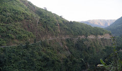
Outside of the city, the 80 kilometers to the border with Bangladesh were relatively uneventful. Once we left the urban area, the intensity of traffic decreased a bit, and the road was pleasantly lined with trees that mostly shaded us. But although the surroundings felt more rural, traffic still crowded the road—buses with extra-loud horns, motorbikes, and rickshaws. It didn’t feel as dangerous as some of the other highways we had biked in West Bengal, as the traffic was traveling more slowly, but we could never relax.

We ate a late lunch near the border, where a “reporter” met us and paid for our lunch. We thought he wanted to interview us, but he asked us no questions, partially because he didn’t speak much English. His photographer, who drove the motorbike both of them rode on, snapped pictures of us every two minutes—they clearly planned to write an article about us, even though the language barrier prevented him from actually asking us questions. We assumed he would make up the stories, much like the reporter in Bihar did.

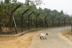
The team followed us to the border, riding just a bit ahead of us on their motorbike. India has built a long fence in an effort to keep immigrants from Bangladesh out of the country. Bangladesh is incredibly poor and densely populated, and tens of millions of people in the country live with a meter of the sea level. As the sea level rises, it’s hard not to wonder where these people are going to go.

Our reporter friend shepherded us through India’s border control. He walked into the office and told the border patrol agents about us, saying something in Bangla about us working on climate change (I only know because to me it sounded like he said “blah blah blah climate blah blah”) and the mustached patrol agents then waved us through with minimal inspection. The reporter was able to communicate to us that he is also a truck driver, which explained his familiarity with the border guards. We got our exit stamp, and in the no-man’s land between the India and Bangladesh the reporter gave us flowers, shook our hands, and then had the camera man capture the moment from several different angles.

India 2 - West Bengal

We passed a duty free shop, where we bought two warm cans of Heineken (assuming that we’d be unable to find alcohol in Muslim Bangladesh), and then rolled our bikes into the Bangladeshi customs office. Bangladesh now offers visa on arrival for U.S. citizens (as well as for citizens of much of the developed world), and all we had to do was pay the $50 per person visa fee. We were supposed to somehow pay at the bank, he told us, but the bank was now closed. They would “figure something out,” he said, but we would have to wait a bit. We gave them a crisp Benjamin, waited around for about 20 minutes (in which time our first border agent drew us a map of Bangladesh, told us about the good places to visit, and taught us how to say hello, good morning, and thank you in Bengla), and then we were free to enter the country.

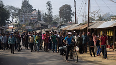
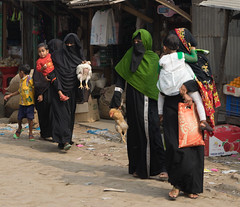
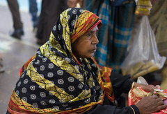
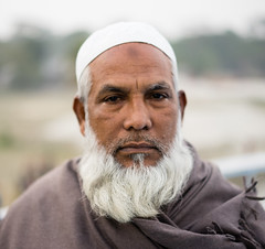
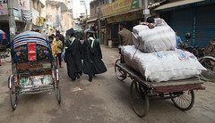
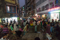
We followed the main road for about a kilometer until it entered Benapole, where our first administrative tasks were amazingly easy: the ATM worked, and I was able to buy a sim card and one gigabyte of data with less hassle than anywhere else we’d been. It gives you confidence in a country when such tasks are easy. People—almost all men, as usual—crowded around us, much like in India. But it felt different. The men had beards and many wore the skullcaps we’ve seen in many Muslim countries. Also, unlike in India, they greeted us and smiled instead of staring blankly. What a difference that makes! So many crowds in India had formed without talking to us or showing facial expressions. Now they actually seemed to be welcoming us, even if it was shyly and there were far too many of them. We also felt safer than we had just across the border, but that is partially because we were told Bangladesh had less crime than the parts of India we had recently cycled through.

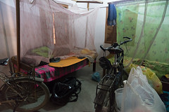
We went straight to the hotel recommended by the Lonely Planet, and didn’t explore the town. Through India and now Bangladesh we had stayed in hotels almost every night. Hotel rooms are the only places in these population dense countries where we have “our space” and no one can stare at us.

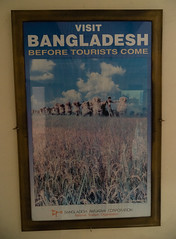
The $15 room had two beds and windows that closed just well enough to mostly keep out the mosquitoes. A poster in the hotel lobby told us to “Visit Bangladesh before the Tourists Come.” I wondered how long it took the Bangladeshi Tourism Board to come up with this slogan. It’s like an empty restaurant telling you to come and eat before all their tables fill up.

Bengladesh 1 - The Delta

Since then, I’ve been trying to come up with alternative slogans. Maybe: “Feel Like A Celebrity: Visit Bangladesh” or “Never Be Lonely: Cycle Bangladesh.”

The next day, we charted our course toward Khulna, the capital of one of Bangladesh’s seven districts, where we had a contact with the head of a local NGO that works with communities in the Sundarbans. As usual, we looked at the walking directions on Google Maps and choose the route that looked the most squiggly.

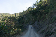
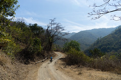
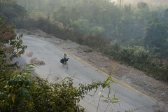
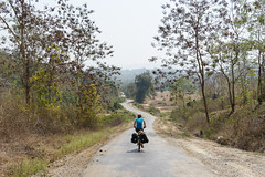
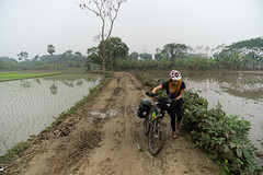
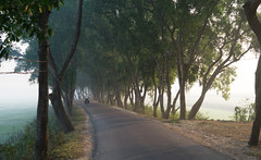
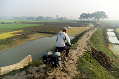
We turned off the main highway and started riding the narrower winding lines we saw on Google Maps. Bike touring with a smartphone feels like a luxury—there’s no way we’d be able to ask directions along this web of back roads. But a pulsing blue dot on the screen instantly shows us where we are, and we can even click to see the satellite view to assess (to a limited degree) the quality of the road ahead.

Bengladesh 1 - The Delta

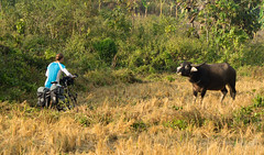
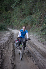
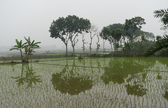
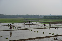
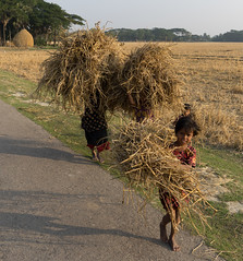
What we found was mostly paved one-lane roads that were raised pathways through semi-flooded fields of rice. We couldn’t stop without a crowd forming, but that seemed to be okay, as again, people smiled and greeted us. In one case, a woman ran away from us and returned with flowers, which we tucked into ourhandlebar bags(a friend of hers also tried to give us a dead snake—we declined). We saw some people plowing fields with a three-wheeled machine that sechurned up mud as it slowly moved down each furrow. Others used oxen. It had rained recently, and in one place we had to push our bikes through mud.

Bengladesh 1 - The Delta

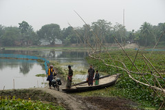
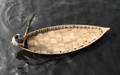
Where Google Maps had said there’d be a ferry, we found a man with a pole on a wooden boat that could carry about a dozen people. We loaded our bikes and were pushed across what appeared to be an oxbow. He asked for 40 cents from us. We gave him the money, and later learned that we had probably overpaid by a factor of ten.

Bengladesh 1 - The Delta

Along this route, we tried to interview a number of people about climate change, showing them a sheet we had printed out with our questions written in Bangla (Are summers warmer or colder than when you were a child? Are winters warmer or colder? Does it rain more or less now than when you were young?) Much like in India, we found that many people couldn’t make much sense of our questions. One person would read the worlds slowly, as if sounding them out. It was as if they were just showing that they could read, and not trying to answer or respond to what was written. According to official statistics, less than sixty percent of adults are “literate” in Bangladesh, and I would guess that the number is lower in the countryside. In China and parts of central Asia and Turkey the literacy rate was much higher, and we could see it in people’s eyes when we handed them our questions. They know how to read and respond to them. In Bangladesh there was more confusion. It was sad to see.

Bengladesh 1 - The Delta

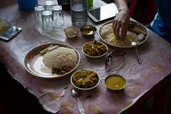
We stopped in a small town for lunch at a restaurant that sold rice and dal. As we ordered, a crowd formed and pushed into the place. The crowd of twenty acted like a two thousand watt heater, warming the already hot restaurant. After we ate the meal, we wanted to sit and relax, but the owner told us we had to leave; the crowd was hurting his business.

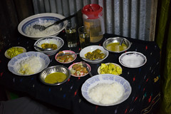
We spent our second evening in Bangladesh in Khulna, where Mowdudur, the founder of the Centre for Coastal Environmental Conservation (CCEC), an environmental NGO that works with communities near the Sundarbans mangrove forest, treated us to a feast at his home and also let us interview him about his work.

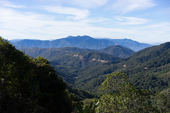
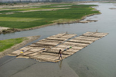
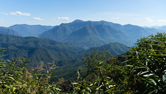
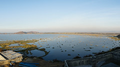
The Sundarbans are the world’s largest mangrove forest, a huge stretch of uninhabited tidally-flooded forest in what is otherwise one of the world’s most population dense nations. The large tides in the Bay of Bengal (about 10 feet!), combined with the huge amount of sediment deposited from rivers, have resulted in a large expanse of land that is just barely above sea level, and which is flooded daily by the tides.

Bengladesh 1 - The Delta

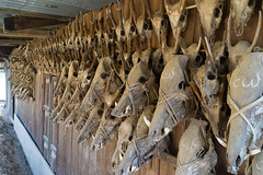
Mowdudur told us that CCED helps find “alternative livelihoods” for people in these communities (basically helping them find work), and that they promote environmental education, helping people learn how to live in better harmony with the forest. Environmental harmony can be a tricky goal, as the mangroves are home to about 400 Bengal tigers, which actually kill a number of people each year.

Early the next morning, we cycled 40 kilometers to Mongla, the location of one of Bangladesh’s two ports and the entry point for the Sundarbans forest. Hiroke, a 25-year-old employee of Mowdudur’s organization, took the bus and joined us in Mongla along with another employee of CCEC (who spoke little English, and whose name we didn’t get). The four of us boarded a boat, and then we motored across the wide river to the Sundarbans visitors’ center.

Bengladesh 1 - The Delta

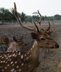
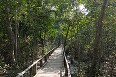
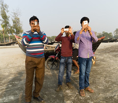
The visitors’ center included a large map of the mangrove forest, a skeleton of a tiger, a fenced-off pen with about two dozen spotted deer (the most common ungulate of the Sundarbans), a family of monkeys in a cage, and a pond with crocodiles. A raised wooden pathway led from the center through the muddy, partially flooded forest. In the forest we watched water flow through a small canal in the mud, responding to the twice-daily tidal shift in water levels. We then climbed up a tower to gaze across a small part of the forest. On the return to the visitor’s center, some monkeys eyed us from the trees, and one of our guides threw some paper into the forest to lure the monkeys closer, as they were clearly used to tourists feeding them (it’s upsetting to see people who work in the environmental sector throw trash into the natural environment, at a wild animal—although littering is something we’ve seen so regularly on this trip, it also isn’t too surprising). We saw a number of Bangladeshi tourists, but no foreigners. In fact, a few of the Bangladeshis took pictures of us as if we were another type of exotic animal.

Bengladesh 1 - The Delta

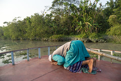
We then crossed the river and met with people living in one of the communities right along the edge of the Sundarbans. With the help of Hiroke, we interviewed three of the community members, asking them whether the winters or summers had changed over their lifetimes, whether storms were worse, and whether the monsoons had changed.

The consistent message we got is that life is hard. The biggest problem, everyone seemed to say, is access to basic freshwater. In the dry season, water is saltier in the river than it was when they were younger. The result is that it is hard to find fresh water for many months of the year. They walk a few kilometers just to get water.

The increased saltiness of the river might be because sea levels have risen slightly, thus pushing salt water further inland. Or it could be because India constructed the Farakka Barrage, which siphons off water from the Ganges in the dry season, allowing less to reach Bangladesh. Or it could be because there is less flow in the river in the dry season due to changes in rainfall, or the development of shrimp farms along the coast.

Bengladesh 1 - The Delta

The people we spoke to agreed that the water levels had been rising. They also said that monsoons are coming later and are less predictable than they once were. While we only interviewed a few people, these comments about the monsoons are fairly consistent with what people in Bihar said and with what experts have told us.

We asked one woman what she thought the future of her village would be. If they couldn’t get water, would people go elsewhere? She said they wouldn’t be able to go anywhere else. “We’re poor,” she said, and there were no resources to move. She also told us about how her children had suffered through cholera and various other ailments. Cholera, we thought. It sounded like something out of the middle ages, and it’s sad to hear of such basic ailments destroying somebody’s family.

We also later learned that one of the women we met was a “tiger widow”—her husband had been killed by one of the large cats. My view on conservation was a bit shaken. The world used to be full of predators that competed with—and sometimes even preyed upon—humans, and humanity has slowly wiped them out over the millennia. North America used to have saber-toothed cats and a bear that stood 12 feet tall. Both were wiped out (almost certainly) by Native Americans. These extinctions are sad, but they also make the forests of the world safe for outdoors people like myself. It’s easy to argue for conservation when the animals aren’t trying to kill us.

We motored on the boat back to Mongla, and before saying goodbye to Hikoke we recorded him, using the voice recorder on my iPhone, asking our basic questions about climate change. We would then use these recordings to interview people in the next few days.

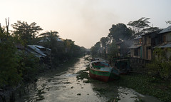
The next night, we followed a small road along the edge of the Sundarbans, where human settlements butt up against the protected mangrove forest. Hiroke had told us that people could build embankments, drain parts of the forest, and then, after a few years, actually farm rice on the soil. Riding along the forest, it was clear that this is what people had done to the land that was currently settled. They had carved out land to farm by building small embankments.

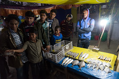
A narrow tidal river, about 20 meters across, separated the settlements from the forest, and we stopped at one place where about a dozen people were crowded around a dock, selling fish. We used Hiroke’s recording to interview one man about climate change (we have no idea what he said—we need someone to translate the video), and then we accepted his offer to take a small wooden boat across the river to visit the forest (he spoke just enough English to invite us). Across the river was a small government building—maybe for hosting tourists, but we never really figured it out. And then we walked around the back, where they had a small pond for aquaculture, and where the forest began. We stood there for a bit, listening to the chirps and buzzes of the creatures in the mangroves. “It isn’t safe here,” said our new friend, speaking English. He told us that tigers had killed about 150 people in the communities in that area (or “at least 150 people”). We didn’t linger.

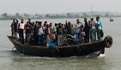
We biked to a mile-and-a-half wide channel, where we found a ferry ready to take us across the river. Google Maps hadn’t shown a ferry, but we’d assumed that such boats would be everywhere there was a river and settlements on either side, and we were right. In fact, the vessel even took us across the river and then 10 km up a canal to the town we had planned to visit, thus cutting off cycling we thought we would need to do. We enjoyed the ride. A woman veiled head to toe tried to talk to Lindsey, but it was tough because she didn’t speak any English (and us no Bangla) and because Lindsey couldn’t see her face, making communication through gesturing and expressions more difficult. At 5pm, a man went to the back of the boat and prostrated himself toward Mecca.

Bengladesh 1 - The Delta

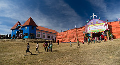
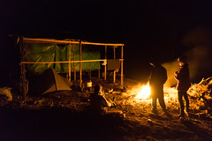
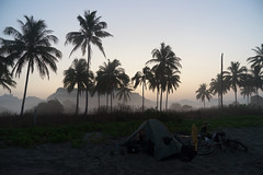
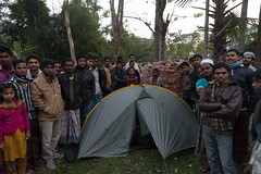
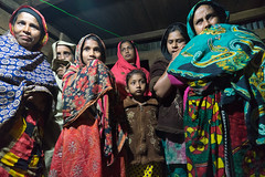
That evening we tried something we haven’t yet done in South Asia: We rolled into a village and asked people where to camp. We played a recording, again from Hiroke, asking in Bangla if we could set our tent somewhere. A crowd gathered. They seemed to suggest we camp by the mosque, a basic one story building with loudspeakers for the call to prayer and a nice grass lawn. I called Mowdudur, our friend in Khulna, and he helped translate over the phone. Mowdudur told us we should go back to the nearest town and find a hotel. We said we didn’t want to—we wanted to camp in the village. We handed the phone to a man who then talked to Mowdudur. When the phone was handed back to me, Mowdudur told us it would be okay to camp by the mosque.

We started setting up our tent, and the crowd (of almost all men) didn’t disperse. They just kept standing there and watching.

Bengladesh 1 - The Delta

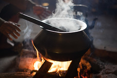
While Lindsey went off to find a bathroom (led by some women, who had somehow materialized on the periphery of the sea of men), I set up the stove and cooked a pasta dinner. The crowd hovered and watched, almost closing in. I sat on the ground and closed my eyes for a second. The people of Bangladesh surrounded me, watching me. It was a strange meditative moment, a way to appreciate the sea of humanity that is Bangladesh. I opened my eyes and continued cooking.

Every now and then someone would take a picture of us with his phone. One young man who spoke English asked me “What is your qualification?”—a strange way of asking what I studied. His “qualification” was English—he was getting a master’s in English (although it seemed like he was far from being a master).

Lindsey returned and told me that we could stay with a woman who offered us her place and had indicated that there was gate that could be locked to keep out the crowd. I agreed we should probably go there, as the crowd did not seem like it would disperse. We first ate our dinner, as the crowd quietly watched us slurp the instant noodles.

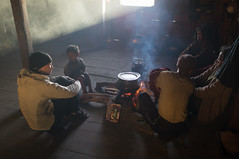
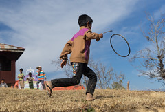
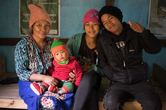
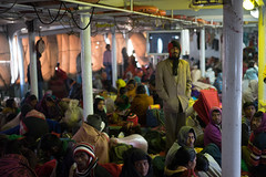
We packed up our tent in the dark and rolled our bikes across the road to the gate of the woman’s home. Her husband was in Saudi Arabia, working. It seems like every family in the rural areas of every country we’ve visited has a family member working abroad. This family had a two-room house, each room probably two-thirds the size of Lindsey’s and my old bedroom back in the states. They also had an outhouse and a yard with a badminton net and two lights that they turned on so that we could hit the shuttlecock back and forth. The woman had said that she would lock the gate, and it was closed, but they kept on letting people in—most likely family and friends—and soon about eight people were watching us play badminton, and another dozen or so were in the house.

Lindsey was not feeling very well, and was hoping that the people would leave and let us rest. It was amazing how many people fit in the house. I worried the floor would collapse under the weight. And it became warm with so many bodies packed in.

Bengladesh 1 - The Delta

Then a man came in who spoke more English. He said something about how he was the commissioner—or something like that—of the town, and somehow an important government official. He told us we had to go the station, and that it wasn’t safe where we were. We should not stay in the house. Right away, we didn’t like him. He seemed like someone who had an inflated sense of himself, who looked down on the family we were staying with. Our intuition trusted him less than the woman who was hosting us.

After a lot of back and forth—in which I told him we couldn’t leave because my wife was sick—he arranged for us to stay in a larger home just across the street where we had our own private room. We don’t know why the headman wanted us to go to another house. We guessed it was because he somehow didn’t approve of the woman hosting us—maybe because her husband was out of the country or something. Or because some men at the house were chewing betel nut and their mouths were red from the mild stimulant.

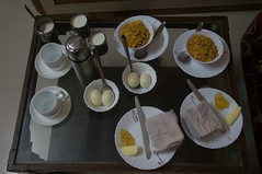
The house we stayed in had four rooms and a concrete squat toilet inside the home instead of outside. We are always amazed by how few things people have in their homes. We often feel like we have more individual items on our bikes than most people own (and we are definitely carrying around greater retail value). We got our own room (someone must have gotten kicked out of their bed), which we could lock. It was hard to be grateful to our new hosts (a family obviously approved of by the headman) when we had been forced to go there, and leave a woman who Lindsey had befriended and liked. However, the new family was friendly and generous, and served us breakfast the following morning. Our friend from the night before also came over, so we got to see her again.

The next day was a series of ferries and short rides as we charted a course toward the Bay of Bengal. A man on a motorcycle befriended us in the late morning, as much as someone with very limited English can, and drove next to us for about a third of the day, including stopping with tea and helping give us directions for finding a boat to Dhaka, which we ended up doing two days later.

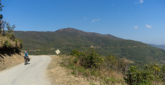
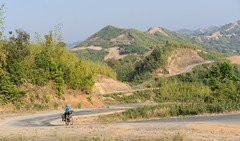
Toward the end of the day, about 15 kilometers away from the beach town of Kuakata, we found one of the narrow paved roads, suitable only for bicycles and motorbikes, that we had come to love. This one was one of our favorites. The population density seemed a bit lower here, perhaps because it was so close to the ocean and the fields were less productive due to saltwater or the increased difficulty in getting freshwater to irrigate.

Bengladesh 1 - The Delta

About forty-five minutes before sunset we started playing people the recording of Hiroke’s voice asking if we could camp. The first people waved us on. The second group stopped and thought about it and told us to wait. I realized that the people there looked different—they appeared Southeast Asian, not South Asian. One girl, who looked to be in her late teens, had mud painted on her cheeks.

The houses also looked different. They were all wooden structures on stilts. One of the people in the group pointed up to one of the houses, basically saying we could stay there. Then we were led by a man who was probably in his fifties around a few of the homes (they were tightly clustered, with trees around them, with fields beyond the trees). He spoke some English and told us we could stay in a room there.

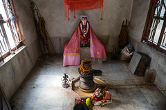
We wheeled our bikes around and brought our bags in. The room had a small shrine to Buddha, and a Buddha calendar.

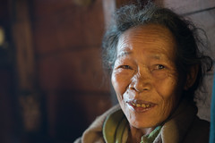
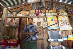
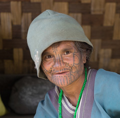
Soon, a pudgy man in his sixties who spoke good English showed up. He told us they were Rakhine people, from Myanmar. Their people had fled Myanmar about 200 years earlier, and had lived in this part of Bangladesh ever since.

He had become an engineer and then went to Iraq in the late 70s to work. At some point he seemed to say he was making weapons, which he seemed not to like—or maybe he was tricked into engineering weapons. He had gone to a missionary school, which is why he spoke English. However, he wasn’t much of a listener, and preferred to talk at us rather than answer our questions, and he had a habit of finishing our sentences with things we weren’t planning to say.

He complained that his people, the Rakhine, were losing land at the hands of the other communities. He also told us about a machine he built that would produce more energy than was put into it using a system of gears and mechanical advantage. I didn’t have the heart to tell him that his perpetual motion machine was impossible, as it violates basic rules of physics. He left us to go home and get the blueprints for this machine, temporarily leaving us alone.

Bengladesh 1 - The Delta

While he was gone, we were alone in the room while the woman of the house did her prayer before the Buddha. At the same time, we heard crickets chirping outside, and in the nearby Muslim village a loudspeaker was conveying the call to prayer.

It was in this moment that “the magic” of the trip came back. Sitting in the Rakhine house on stilts, we were jolted into realizing where we were: in a remote corner of Bangladesh, hosted by people we had met that day, with people praying to different gods all around us. The mix of crickets, Muslim prayer, and Buddhist chants felt like a declaration about the beauty, diversity, and generosity of the world. Moments like this are a major reason why we rode our bikes across Asia.

Our friend returned with blueprints and a series of letters from various potential funders rejecting his requests for money. The blueprints were professionally drawn, clearly demonstrating that he had training in design. But it was still a drawing for a perpetual motion machine. I’ll believe in the Buddha before I believe in that.

Our hosts served us a dinner—an assortment of meats, some rice, and what we thought were eggs but which had a peculiar membrane connecting them, making us suspect that they were in fact organs of an unknown animal. We didn’t eat those. Our hosts, though, didn’t speak to us. They just gave us food and walked back into the kitchen, leaving us to hang out on our own.

We slept well that night, listening to the crickets.

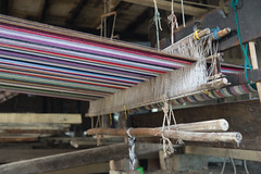
In the morning, our hostess gave us a blanket that she had woven herself. She said it took her three days to make.

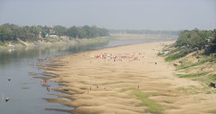
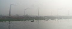
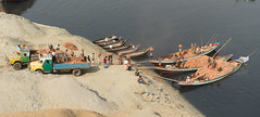
We followed a long route to the beach. I regretted this when Lindsey was feeling sick and we were pushing our bikes through the sand. But we also saw rows of boats and fish drying, recently caught, and we rode along the embankment that protected the farmland from the ocean. I found the embankment relatively unimpressive. I think it was supposed to be 5 meters (16 feet) tall, but it seemed shorter to me. I would definitely want more between me and the next cyclone.

We made it to town around 2pm, at which point we found the nicest hotel in town ($15 for the night) and took a nap. We then walked to the beach.

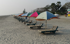
Kaukata is a tourist town for Bangladeshi tourists, not foreigners. It had the relaxed feeling of a beach town. But the shops were targeted at Bangladeshis. The little open-air booths sold knick-knacks such as shells and cheap necklaces. We saw only four other foreigners in the town.

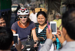
The beach chairs were mostly empty. It was December and the temperature was in the high sixties, which is downright freezing if you’re a Bangladeshi. We strolled down the wide beach, walking by the rows of empty beach chairs. Although the beach wasn’t crowded, every now and then a group of Bangladeshis would approach us and request—no, demand—a picture with the foreigners.

Bengladesh 1 - The Delta

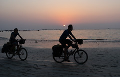
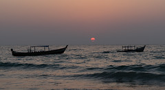
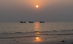
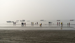
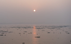
It felt nice to sit on the beach, even if we could only do so for 20 minutes before being approached, and even if it wasn’t quite warm enough to enjoy the water. The Bay of Bengal was mostly calm, and the beach curved in such a way that we could watch both the sunrise and the sunset over the water. We chose to see only the sunset—we’ve seen enough sunrises on this journey.

Bengladesh 1 - The Delta

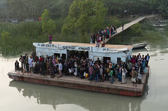
We left town at about 11am the next morning and biked the 45 kilometers to a dock where a three-story boat, which we planned to take to Dhaka, waited for us. We rolled our bike along a wooden ramp to the boat, where we were led to a small cabin. For $10 each, we got a 24-hour boat ride and our own cabin. Our journey through the heart of the Ganges Delta had come to an end. We had achieved our trip’s goal of reaching the mouth of the Ganges.

Bengladesh 1 - The Delta

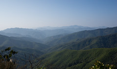
Unlike the parts of India we had just recently traveled, I would recommend Bangladesh to other cycle tourists. When I now look at the impressive satellite image of the waterways snaking through the green islands of the mouth of the Ganges, I think not only of the country’s vulnerability to climate change; I think of how you can roll your bike up to almost any of these rivers and find a boat ready to take you across it. And I think of the one-lane roads raised above the flooded rice fields, the crowd of friendly men who surrounded our tent, and the cricket-Buddhist-Muslim music we enjoyed just a few miles from the Bay of Bengal.


Kolkata – Adaptation, renewable energy, and sustainable sourcing

January 4th, 2015 by Lindsey

Kolkata (Calcutta) was not directly en route from Nepal to Bangladesh, but we went there to get visas for Bangladesh (the embassy in Kathmandu could not provide them) and also so we could visit a large Indian city. Our experience of India was far less comprehensive than our time in China, which we crossed west to east in a serpentine manner, visiting roughly a dozen provinces over two and a half months. From Nepal, we crossed the border into Bihar, biked east across the state until reaching West Bengal, and then rode to Kolkata. While we didn’t get our visas there—we learned at the embassy that Bangladesh now offers visa on arrival (at least at the Benapole border)—we did manage to meet with several people working on climate and energy issues and celebrated the New Year with some lovely new friends.

India 2 - West Bengal

Adaptation in the Sundarbans

We had the chance to discuss climate change in the Sundarbans with Asish Ghosh of Center for Environment and Development (CENDV) and Anurag Danda of WWF-India. The Sundarbans is a region of about 10,000 square kilometers that straddles the border of India and Bangladesh where the countries meet the Bay of Bengal. Lying in the enormous delta where the Ganges (Padma), Brahmaputra, and Meghna Rivers empty into the Bay after their journey across the subcontinent from the Tibetan Plateau, the Sundarbans is the largest mangrove forest in the world. A large portion of the area is protected as a national park, wildlife reserve, and UNESCO World Heritage Site—the Sundarbans is the largest reserve for the Bengal tiger. The region is a vast network of rivers, creeks, and flat, low-lying islands, and the people living there are often held up as the poster children of vulnerability to climate change, and particularly to sea level rise.

The Indian Sundarbans are experiencing sea level rise and temperature increases at a faster rate than the global average, and farmers are already noticing changes. Data shows that while overall precipitation amounts have not changed, the timing and intensity of rainfall has, with short periods of very heavy rainfall occurring sporadically throughout the rainy season. CENDV is working with other deltaic regions in the world to help develop adaptation strategies. One of the major challenges the region faces is cyclones, which are projected to grow more intense as a result of climate change. In 2009, Cyclone Aila hit the region, destroying over 1000 km of the embankments that normally keep saltwater out of people’s villages and farms. After the cyclone, farmers were unable to grow rice in fields that had been inundated with saltwater, and CENDV helped locate and disseminate salt-tolerant varieties of rice. CENDV also studies migration, which is already occurring as people leave the villages in search of work or because their homes were destroyed, and which is anticipated to increase as climate change and natural disasters make it more and more difficult to sustain livelihoods in the region.

Dr. Danda told us that WWF works with communities near conservation areas that the organization supports. The Sundarbans, as a UNESCO World Heritage Site and reserve for some of the world’s most charismatic megafauna, receive a lot of attention when it comes to wildlife conservation, but the people living nearby are not so lucky. If their villages become uninhabitable, the nearby protected area is off limits for migration, and they can’t count on the government for protection. We learned that while some of India’s islands are likely to be protected for strategic purposes (because their very presence serves to maintain / expand the country’s territory at sea), the four million people in the Sundarbans, and the area itself, are not high on the government’s list of priorities.

Projections indicate that at least a quarter of these people will have to leave their homes in the next 30 years due to sea level rise, erosion, extreme events, and increases to the already large population. To help prepare for this, WWF helps young people—who for the most part only know farming and fishing—develop skills that will serve them if agriculture is no longer viable, or if they migrate to urban areas. These skills include basic education—the organization helps promising students find scholarships to advance their studies and pursue professions such as engineering and medicine—as well as training for work in the hospitality sector, construction, and driving.

These meetings were our introduction to the Sundarbans, which we would later visit on the Bangladeshi side of the border. What we learned is that climate change is already being felt in this area, both in the dramatic way portrayed on the news—with islands disappearing as sea level rises—as well as in more subtle ways. Changing rainfall patterns can destroy crops, tidal surges erode islands, and increased salinity—which has a variety of causes, including sea level rise and flooding during cyclones—can make farming impossible in some areas. It was encouraging, though, to see that organizations such as CENDV and WWF, along with others, are working to soften the blow. Developing or discovering rice varieties that can tolerate salt, submergence, or drought improves food security, while skill development gives people options outside of farming and could make it easier to survive if migration becomes necessary.

Renewable Energy

We had the opportunity to visit the offices of SwitchOn and ONergy, a joint NGO-business organization that helps bring renewable energy to rural people in eastern India, where 50% of households are not connected to the grid. SwitchOn, the NGO, was started in 2008 to do outreach, policy advocacy, and capacity building around climate change and sustainable livelihoods. ONergy, the business side of the organization, was started in 2009 to provide solar energy to underserved communities. ONergy uses innovative approaches such as distribution centers and micro-finance to make solar electricity and technology affordable, while SwitchOn helps build capacity among communities to install, maintain, and maximize the benefits of the technology.

The vision for SwitchOn began after founders Ekta and Vinay Jaju traveled with a friend from Kolkata to New Delhi by bicycle, following India’s coal belt. Along the way, they spoke with experts, activists, and affected communities about the impacts of mining coal. What they learned—about sinking towns, burning ground, and other effects—are detailed in the video, Why New Coal.

Why New Coal from Vinay Jaju on Vimeo.

Upon returning to Kolkata, Ekta and Jaju started SwitchOn and later ONergy, which have so far affected about 200,000 lives, with a goal of affecting one million lives by 2016 and ten million lives by 2022. The major benefits of solar electricity come from simply having convenient access to light. Instead of kerosene, which is smoky and provides poor quality light, SwitchOn/ONergy’s beneficiaries and customers can flip a switch and have high quality light for studying, working, and entertainment. The organization also provides street lighting, water heating systems, and cook stoves, as well as solar-powered technology in the agricultural sector, such as cold storage and irrigation systems.

We also spoke with Subhro Sen at WWF, who works on rural electrification in the Sundarbans. The program he described uses distribution centers and financing models to make the products affordable and to ensure that they are well maintained and provide the intended services to customers. One of our questions for both organizations was whether these sorts of projects could actually result in delaying connection to the grid for the communities they served. We learned that grid power and diesel, which is often used in generators and to pump water, are highly subsidized and therefore very cheap, making it difficult for solar power to be cost-competitive. Ekta told us, though, that over time solar is cheaper than diesel, and the hope is that eventually some of ONergy’s customers can become producers of solar energy. Then, if the government expands the grid to them, they can sell power back to it.

India 1 - Bihar

While it’s inspiring to learn about the positive impacts these organizations are having on people’s lives, it frustrates me that the government isn’t able to deliver such services. I am a strong supporter of renewable energy and this type of work, and I can definitely see the case for new electrification to be sustainable and low-fossil fuel. However, I can’t help but note a disconnect—maybe even an irony—in that the people who will be most affected by climate change, and who have contributed basically nothing to causing it, are the ones using renewables while much of the developed world goes on using fossil fuels. If the market is large enough, perhaps it will contribute to bringing down the cost of renewables and mainstreaming them, but this is something that everybody should be contributing to. Nonetheless, these sorts of projects are inspiring in that they are helping to improve people’s standard of living without contributing to climate change, which David writes about extensively in The Bicycle Diaries, and which is such a contentious and important issue in the international climate negotiations.

Sustainable Sourcing

Our final meeting in Kolkata was with ITC, one of India’s largest companies. We met with Dr. Ashesh Ambasta, Vice President and Head of Social Investments; Sanjib Bezbaroa, Vice President and Head of Corporate Environment, Health and Safety; and Nazeeb Arif, Vice President Corporate Communications, who told us about the company’s ‘triple bottom line’ approach to business. ITC’s products range from paper to food to hotels, and what stuck with me is that the company is able to support millions of what they call sustainable livelihoods as part of their business practices. For instance, they are “carbon positive,” “water positive,” and “solid waste recycling positive.” This means that they use a high percentage of renewable energy sources and sequester more CO2 than they produce through afforestation projects; ‘create’ more water than they use through rainwater harvesting and other means to capture runoff for use in irrigation; and recycle more waste than is produced from their operations.

India 2 - West Bengal

They showed us a video of communities where the raw materials for their products are grown, with testimonials of how people’s lives had improved. For example, the company provided saplings for trees that could grow in degraded farmland that was no longer productive, and the farmers were then able to make a living planting and tending the trees before selling them for paper production. This is done in a seven-year cycle rather than through clear-cutting, and more trees are now grown than the company can use, so farmers sell to other companies as well. ITC began this project at a time when most pulp was imported, and they are proud of creating both demand for and supply of domestically produced pulp, as it provides livelihoods for local people and, when managed correctly, improves the environment where the trees are grown. There were many such examples of triple bottom line practices that the company has implemented, often in partnership with civil society. In communities where they source agricultural products such as wheat, for example, the company has invested in infrastructure to harvest rainwater for irrigation, at the same time training and empowering local people to build and maintain such systems.

Interestingly, the company’s motivation does not come from its customers. While organic and fair trade labels are gaining in popularity in US and European markets, the people we met with at ITC said these issues are not really on the radar of Indian consumers. Instead, the company is motivated by the idea of ‘country before company’ and by profit. ITC is proud to support producers within India and contribute to the country’s economy—as they say, businesses can’t succeed in societies that fail. By creating sustainable livelihoods and supply chains, they are creating a secure base for their own operations. ITC, a $45 billion market cap company, is one of the top three companies on the Indian stock exchange. From what we learned, this success appears to be in part because of—rather than in spite of—their investment in sustainable livelihoods around the country.

After a whirlwind two and a half days in Kolkata, we rode out of the city on a rainy morning, accompanied by a camera crew for eTV and bound for Bangladesh. Stay tuned for updates from the front lines of climate change, the Sundarbans themselves.

India 2 - West Bengal


Bihar and West Bengal – Photos

January 1st, 2015 by David

To see all our photos from eastern central India, visit our Flickr album of Bihar and West Bengal. Our favorite pictures from these albums are below.